By Lucy
The hike got off to a slow start.
To begin with, we couldn’t leave until 10, when Hanuman’s shift at the hostel was over.
I slept in! Presumably catching up on the sleep I had lost over the weekend, and the punishment I was putting my poor body through. We were finally on the road at 10:30.
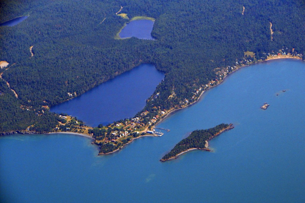
It takes about an hour to drive to the park from even the most easterly part of Thunder Bay. Partially because the Sibley peninsula is at an acute angle from the city itself, so you have to backtrack a bit in terms of latitude. Partially because the Sibley peninsula itself is quite long and the Sleeping Giant is at the very tip.
The Sibley peninsula is so named, because a white guy named Alexander Sibley bought the silver mine that Silver Islet is named for, and stole the pure silver in its depths from the indigenous people.
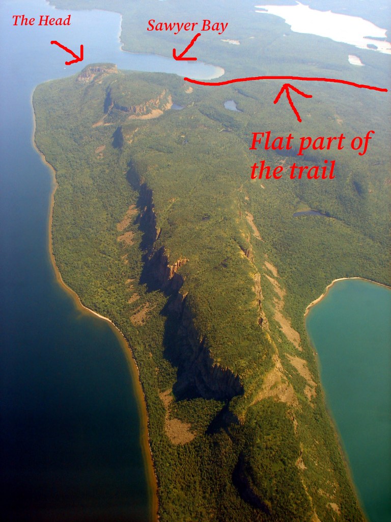
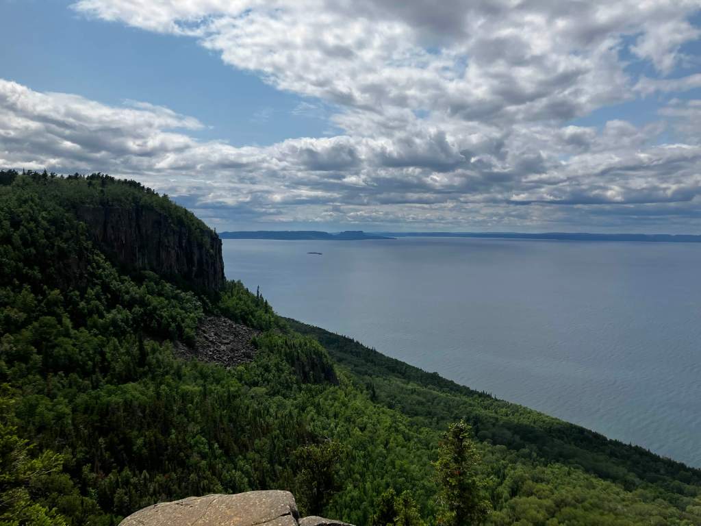
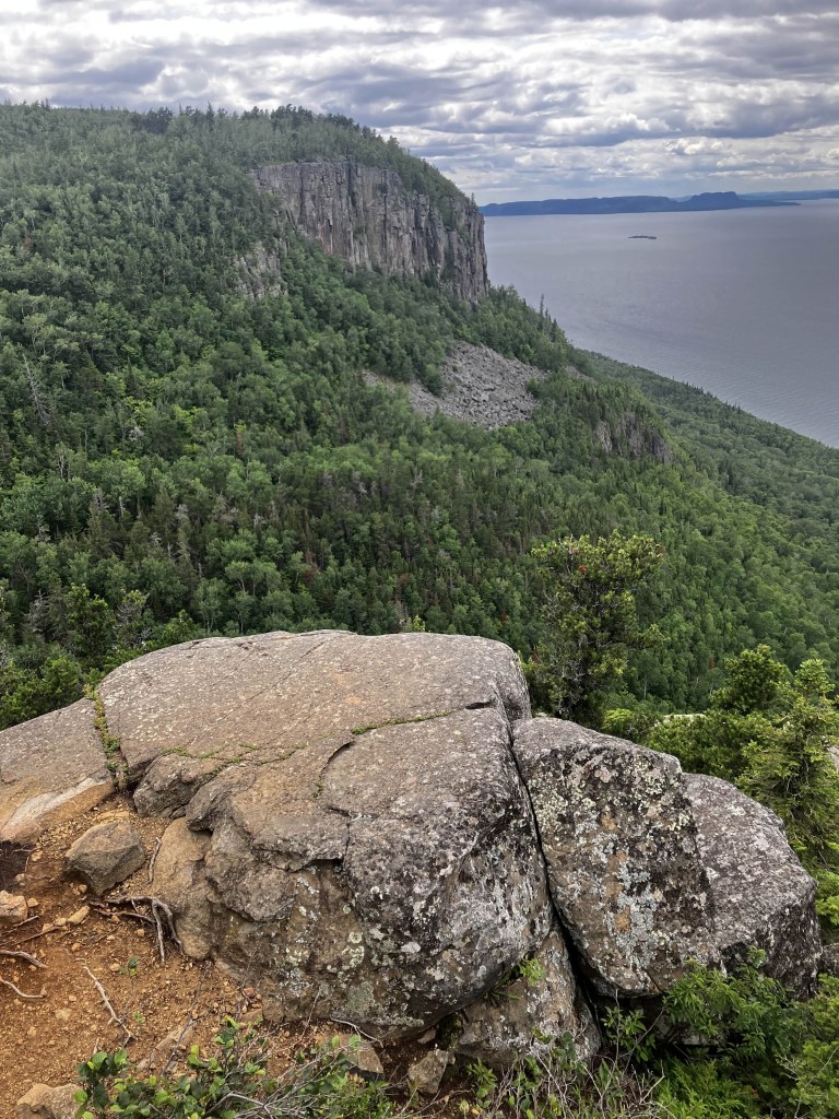
The Sleeping Giant itself is named because… well, look at it!

It really does look like a man, laying down with his arms crossed over his chest!
There’s a multitude of myths associated with the giant. The most common is that the giant was turned to stone as punishment for telling the white men where to find the silver vein. However, there is another version where he is protecting the mine for people who would pillage it. I wonder if the story was that he was protecting the vein, until it was mined, at which point the story changed.
In any case, the Sibley peninsula itself is a paradise for the avid hiker/ camper. There are hundreds of kilometers of hiking trails, opportunities for kayaking, and dozens of campsites. You could easily apply for a monthly camping pass and have a new camp site every day.
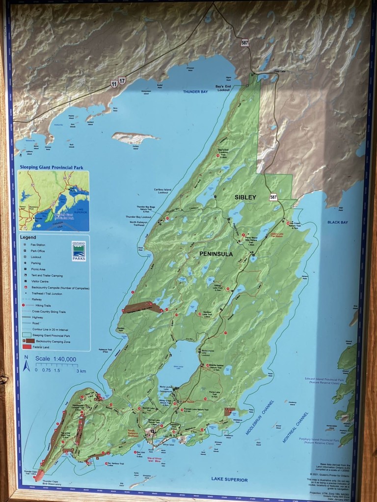
The trail I had picked for us today was the Head of the Giant, E.I. the metamorphic rock sill that looks like the head at a distance. It is possibly the most difficult trail on peninsula in hindsight, but hindsight is 20/20!
The only suitable bag I had was the little rainbow backpack with string straps they gave us at Pride last year. I packed;
- a roll of toilet paper
- Metamucil, potassium supplements, Tylenol
- a container of cheese and meat snacks
- the smorgasbord of Keto snacks I’d bought the other day
- sunscreen
- a pack of gum
- 2 bottles of water with some lemon in them, and one bottle of green tea
I wore my old ratty sneakers, thick socks, cargo pants, and a t-shirt. I debated bringing a sweater or rain jacket, but decided to throw on the long-sleeved high-vis shirt work had given me. It is light and has holes for air flow.
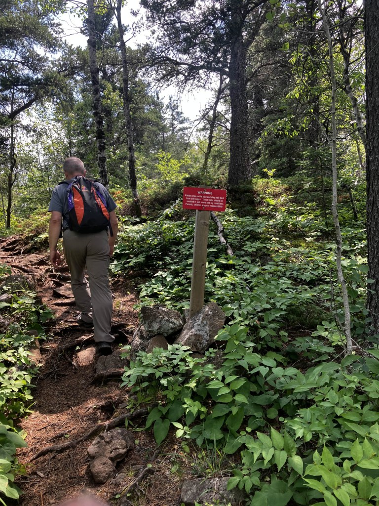
When I tipped over the bag to dump out all the rainbow gear it had come with, a bright orange whistle fell out. Presumably a rape whistle, but whistles of any kind are welcome on trails like this. They can summon help if someone is hurt. There was also quite a few notices and warnings about black bear activity in the area.

Now, some people will tell you to play dead when confronted by a bear. Those people are wrong. Bears, and black bears in particular, are hilariously lazy. Carrion is good food for them. A living human is too much effort when there are patches of berries over yonder (black bears are omnivores). The way to discourage a bear that is checking you out is to make as much noise as possible, make yourself big and annoying, so they’ll decided killing you is too much effort. Even if you’re out of breath, a good whistle can make a lot of noise.
We stopped at the Marie Louise campground to buy a park pass. Then we parked at the trail.
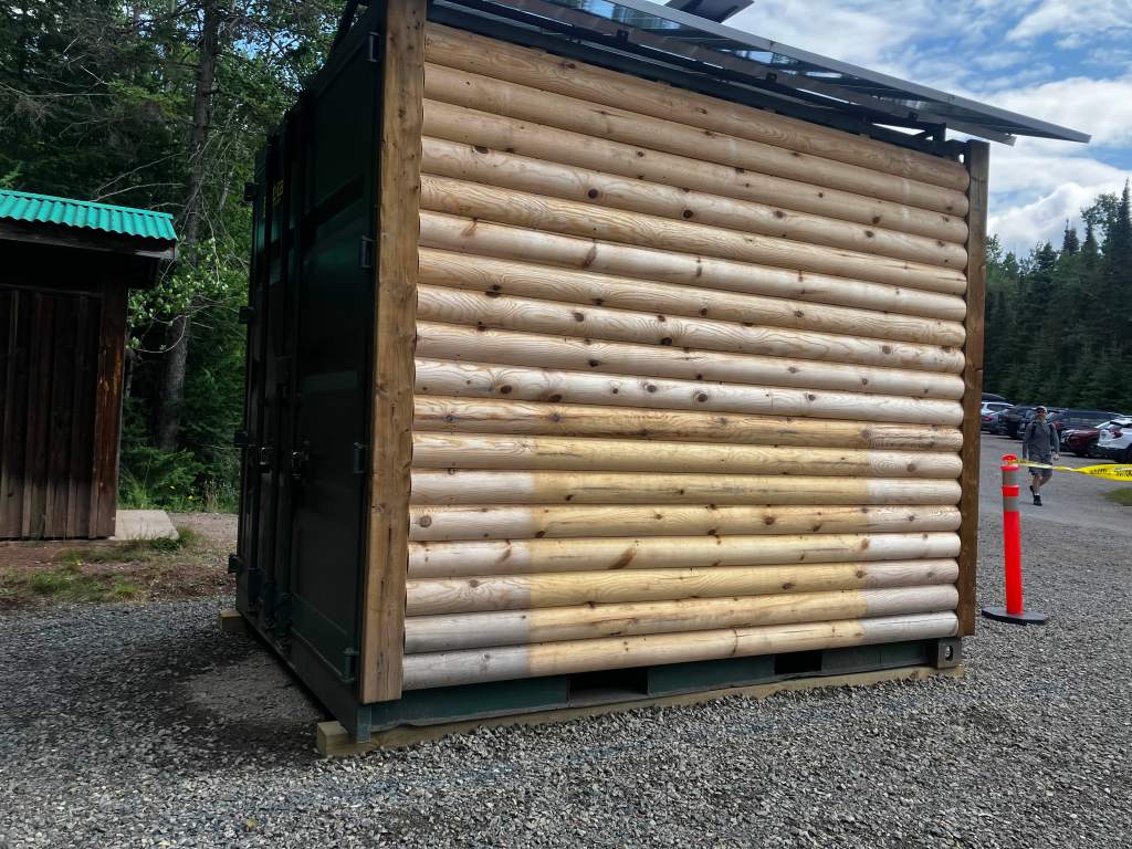
There was a sea-can that someone had covered with pine siding… for some reason. I wonder if it is intended to be a new bathroom, or perhaps storage for trail maintenance equipment.
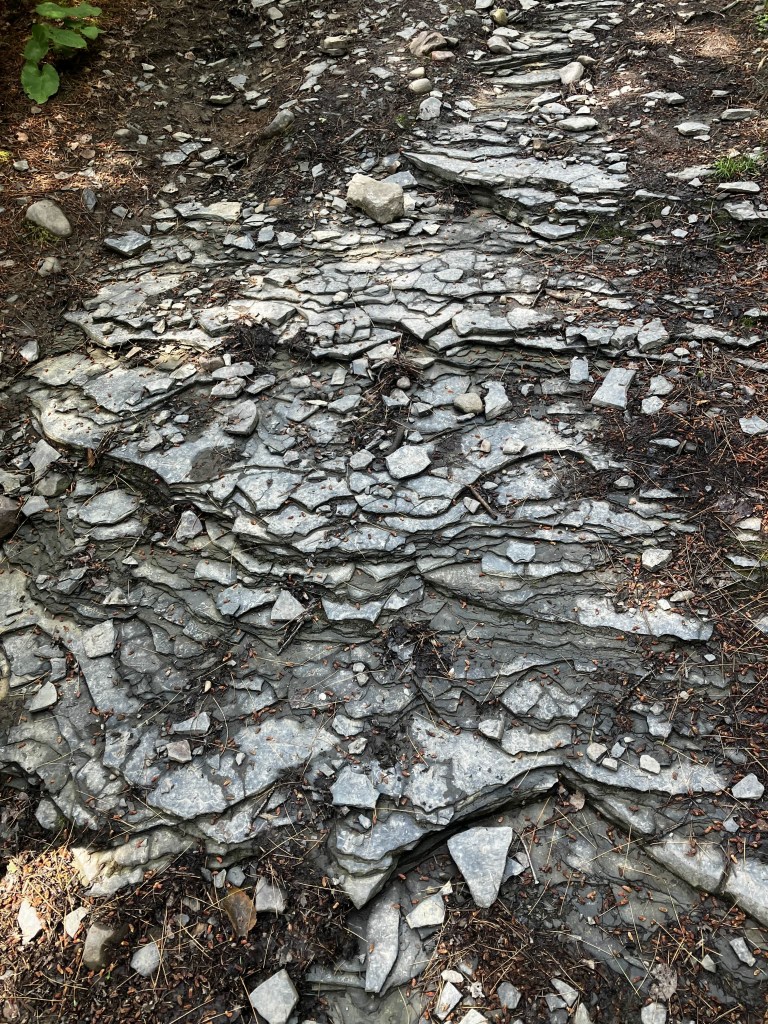
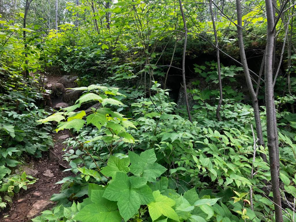
Every person and website we consulted said the trail is boringly flat until the head itself. For the record, it is not, at least not as far as I’m concerned. It is decently flat, but the ‘up’ parts are quite steep, and littered with broken shale, which can be treacherously slippery.
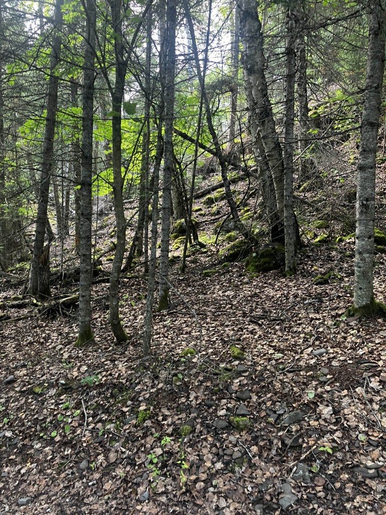
You start on the main trail for about 400 metres. Even in the midday sun, the tree cover is thick and blocks most of the light. Mosquitoes were abundant, but me and Hanuman never bother with bug spray. Somehow people survived thousands of years without commercials bug spray! If you keep a good pace they shouldn’t bother you.
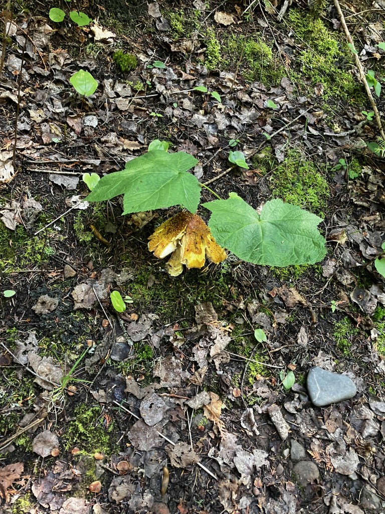
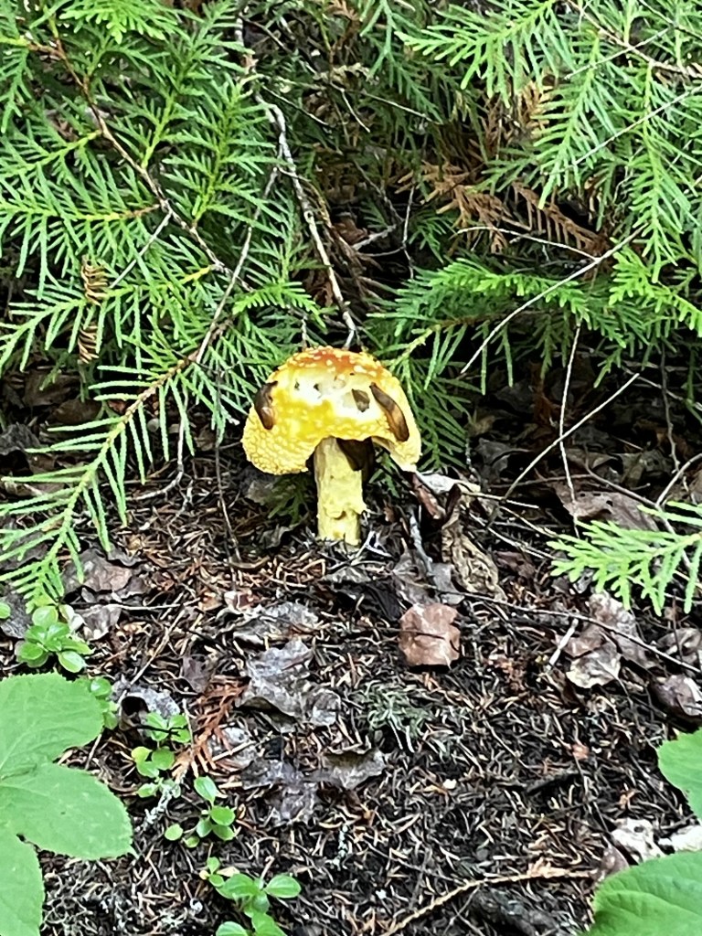
We encountered a lot of golden mushrooms that looked like chanterelles but were not.
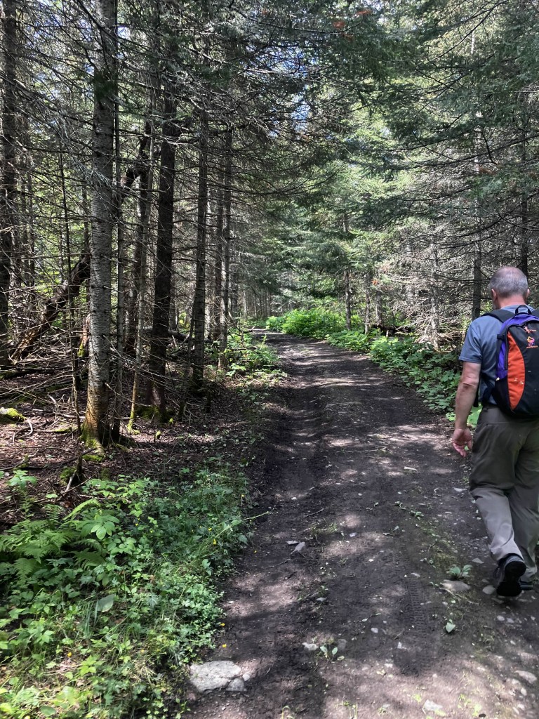
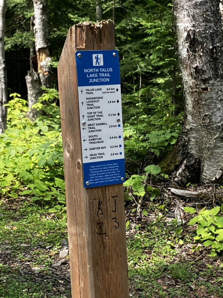
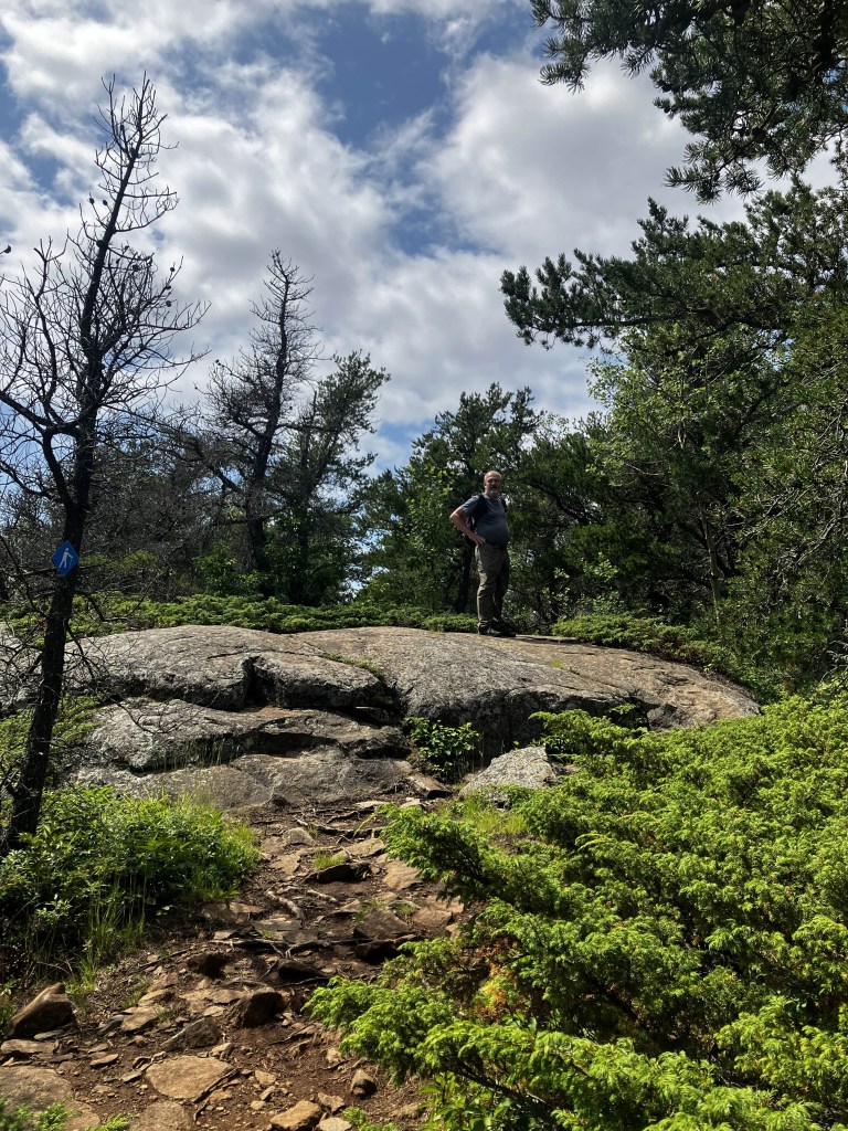
After about forty minutes of walking we hit the first fork in the road, which was good because both of us were starting to become concerned that we had somehow gotten on the wrong trail. The marker confirmed we were on the right trail. I was having a hard time getting warmed up, possibly due to the Keto diet, so we had a sit down and a snack here. I was constantly trailing behind Hanuman, but I know he’s patient and understanding.
At this point, I had finished my bottle of green tea and was starting to become concerned I hadn’t brought enough liquid.
After another 50 or so minutes of walking, we reach Sawyer Bay. There is an outhouse here, which is not stacked with toilet paper, although when I went in there some good Samaritan had left a roll (or forgotten it). I opted to use my own roll and leave it there for someone else who was less prepared.
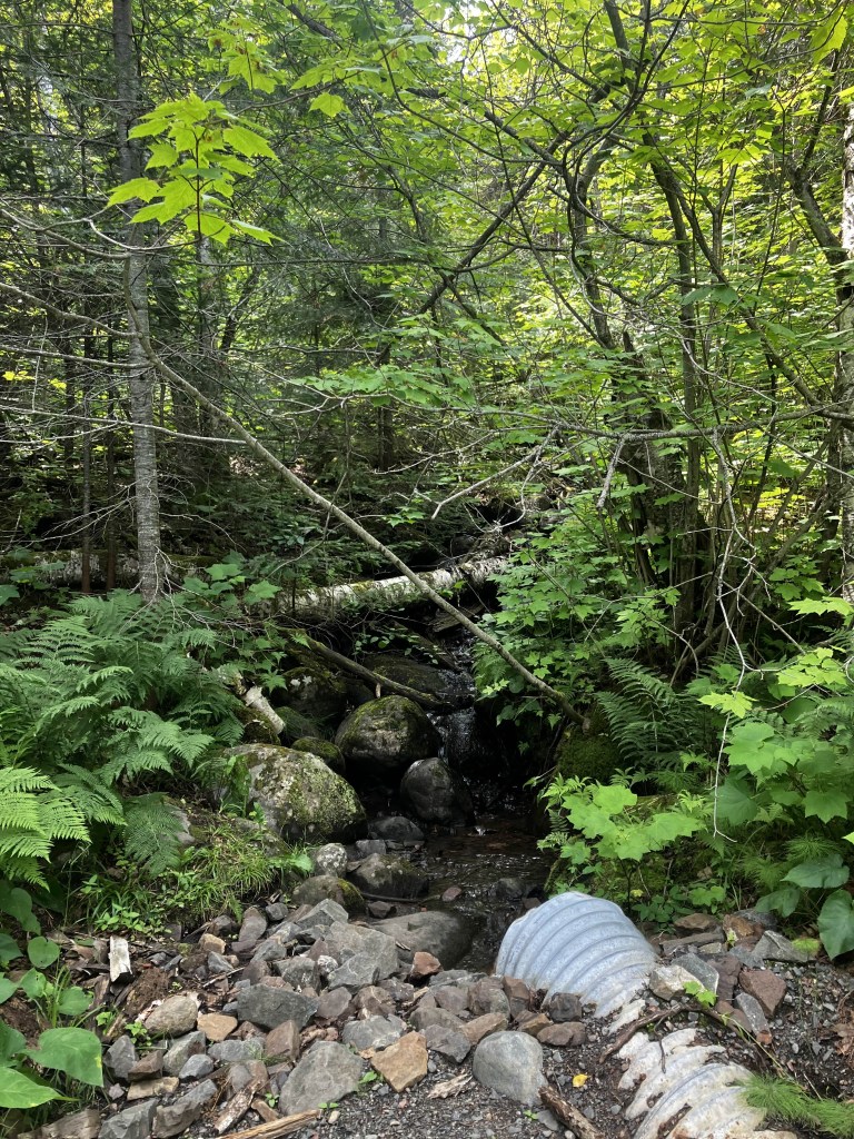
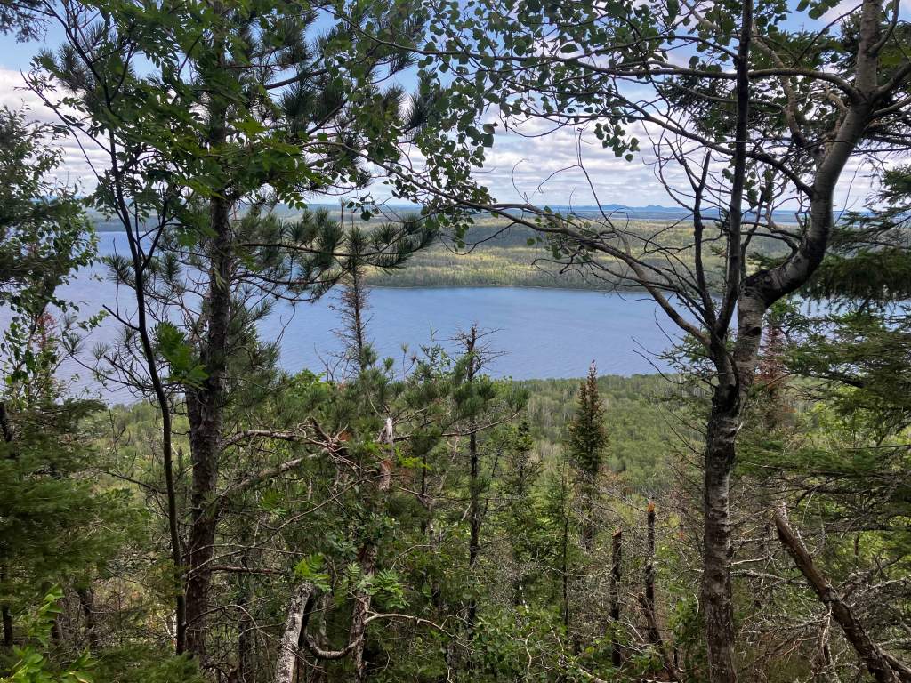
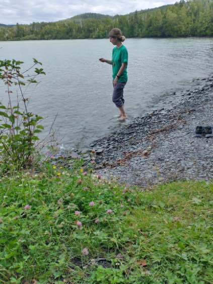
The water of the bay itself is gorgeous, crystal clear and blue. The beach is rocky, mind you – wouldn’t recommend swimming, unless you have water socks and an excellent sense of balance. There was a group of four elderly hikers sharing a fire by the water, and we sat with them for a bit until they decided to move on.
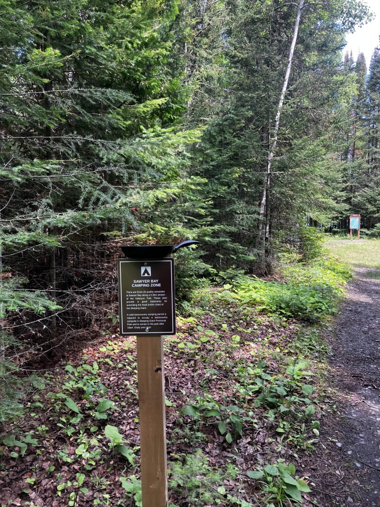
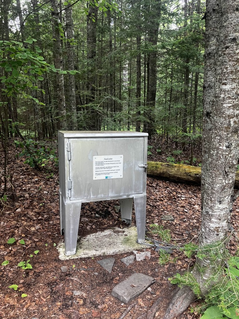
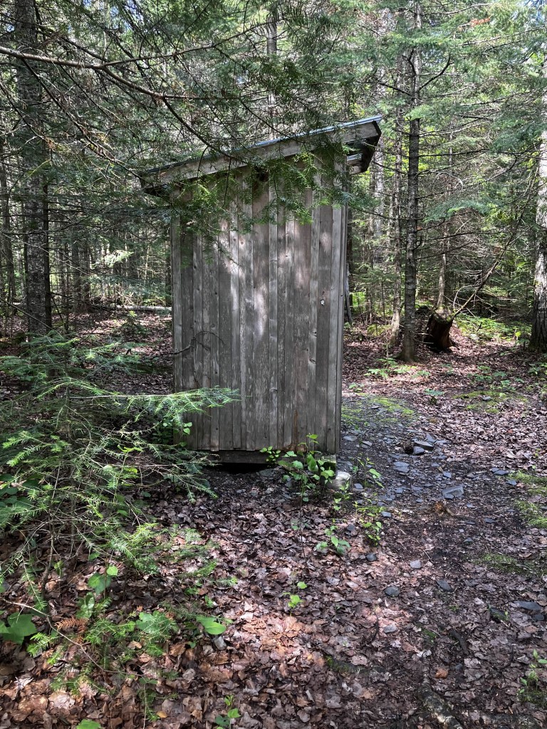
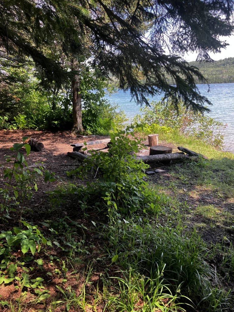

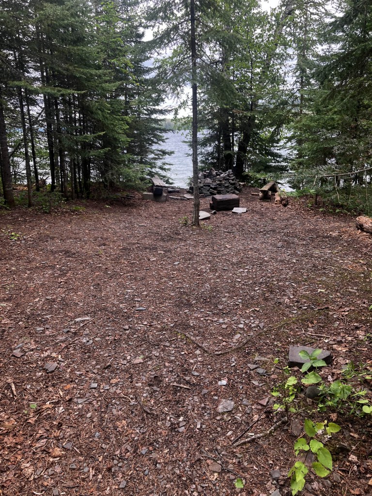

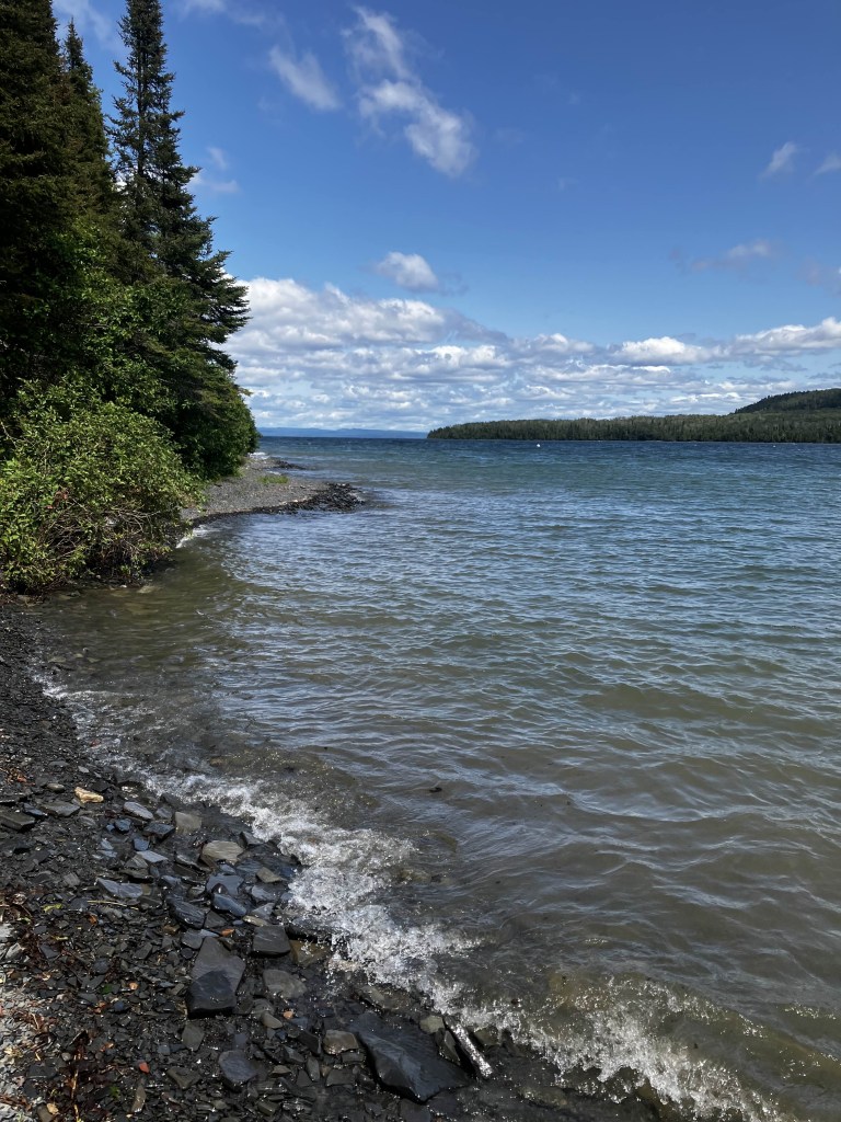
Sawyer Bay is one of the “backcountry” camping sites available in the park. There is no running water, electricity, or anything beyond a privy and a food locker. Still, it looks like a lovely spot to camp if you like to rough it – there’s a ready supply of water for the adventurer who has a purification system.
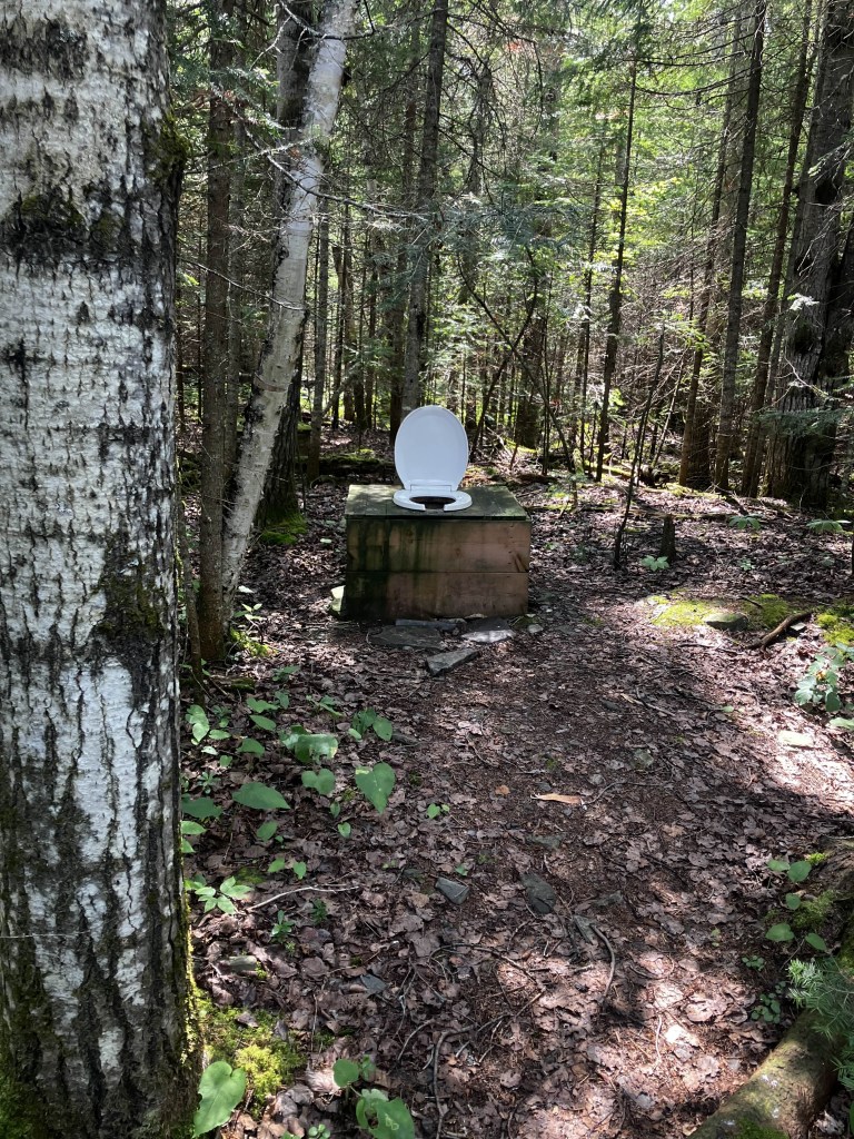
A little bit beyond the camp sites was a ‘throne’ with no building around it, which Hanuman said is pretty normal but reduced me to a fit of giggles.
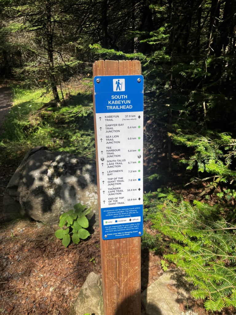
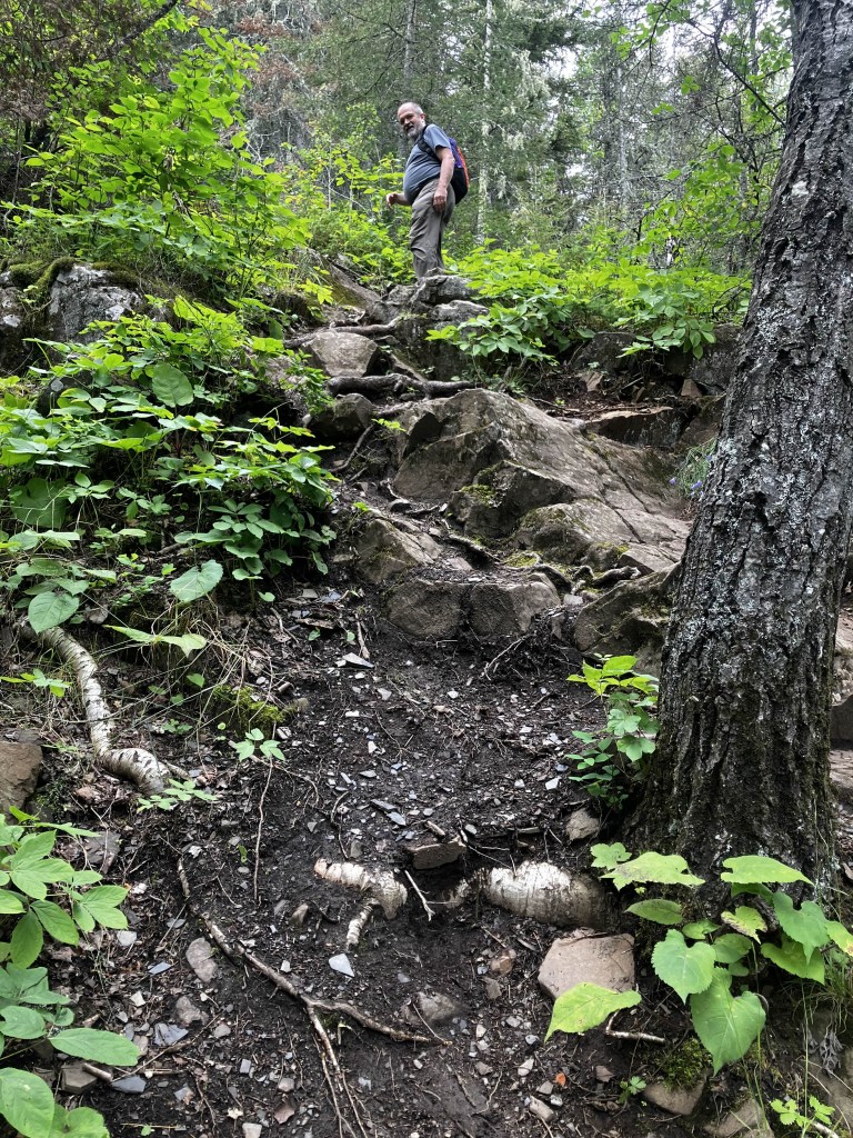
About ten minutes past the camps was the sign for the head, and the ascent began!
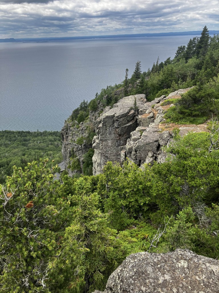
It’s vertical. I mean, literally. There are large chunks where you have to go on your hands and feet and you are basically rock climbing. There are quite a few sections covered in jagged, broken chunks of shale, and they are quite slippery even when you are on even ground, so slow is the way to go!
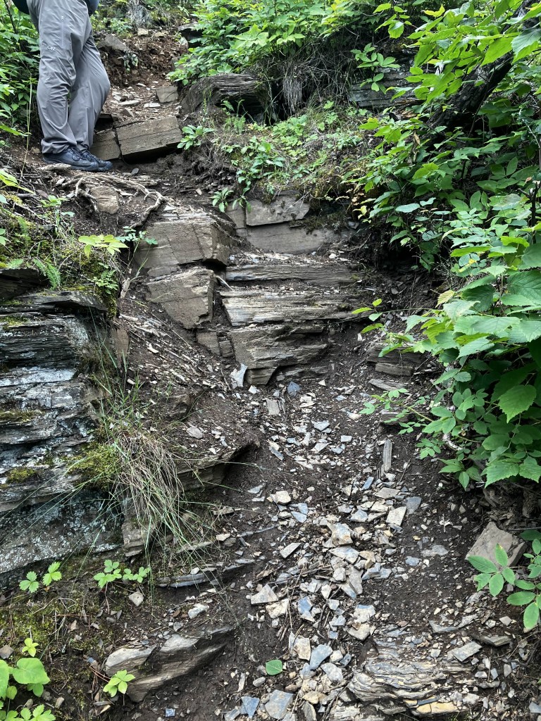
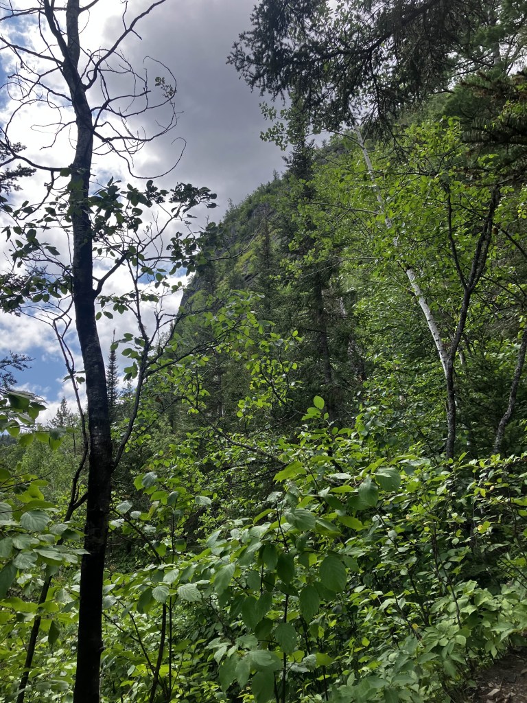
I did love the sections where you could see how the igneous rock had folded and pressed together. Like perfectly laminated layers of the world’s largest croissant!
You can tell when you’ve reached the halfway mark, because you pass the tree line for the poplars and the breeze changes. It becomes a stiffer “sea breeze”, cold and wet from the lake, even more so than by Sawyer Bay.
We passed a fair few people on the way up. They all said “almost there!
and they were all lying. I started to wonder if I’d bit off more than I could chew when I noticed this.
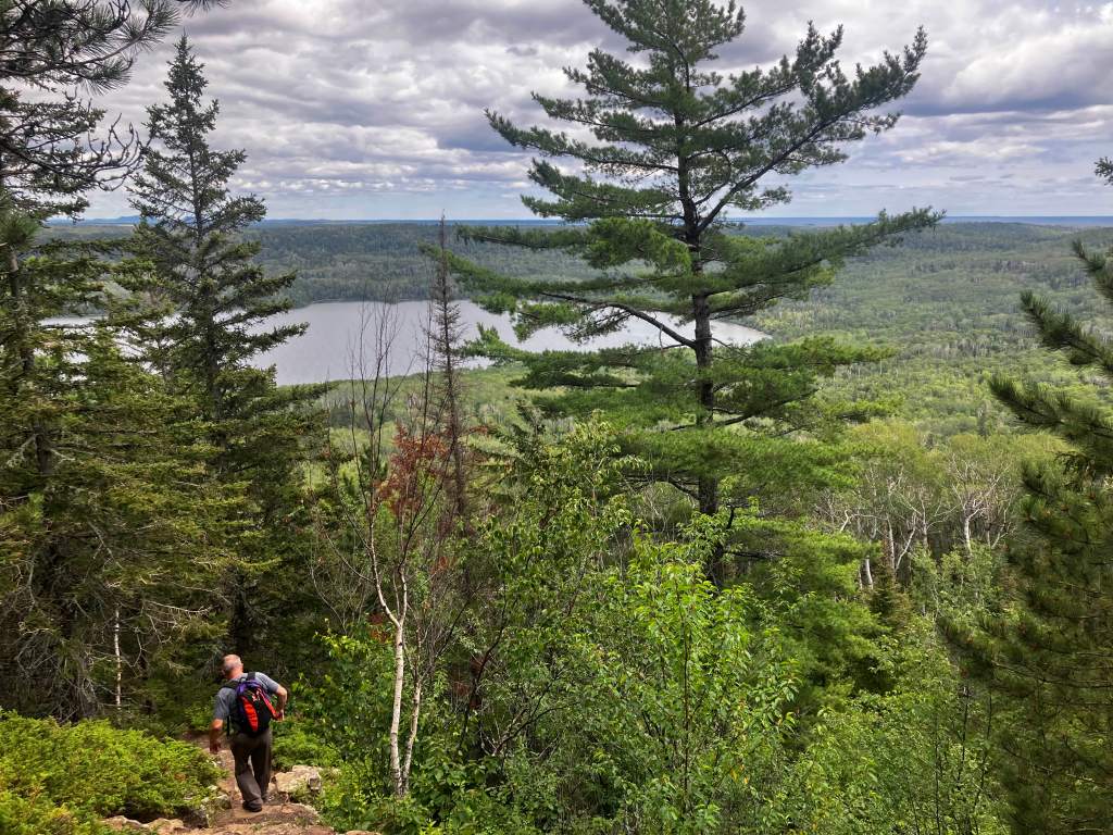
It’s at least a kilometer and a half of upwards motion. No one can agree on the exact elevation gain, but it’s somewhere in the range of 500-600 meters, or 160 storeys! The CN tower itself is only 340 meters to the regular observation deck, and 450 to the Skypod, so we climbed more than there are stairs in the CN Tower! It took us almost an hour to do it, and there was a good chunk of me stopping to sit down and catch my breath while Hanuman waited patiently ahead.
And then we’d made it.


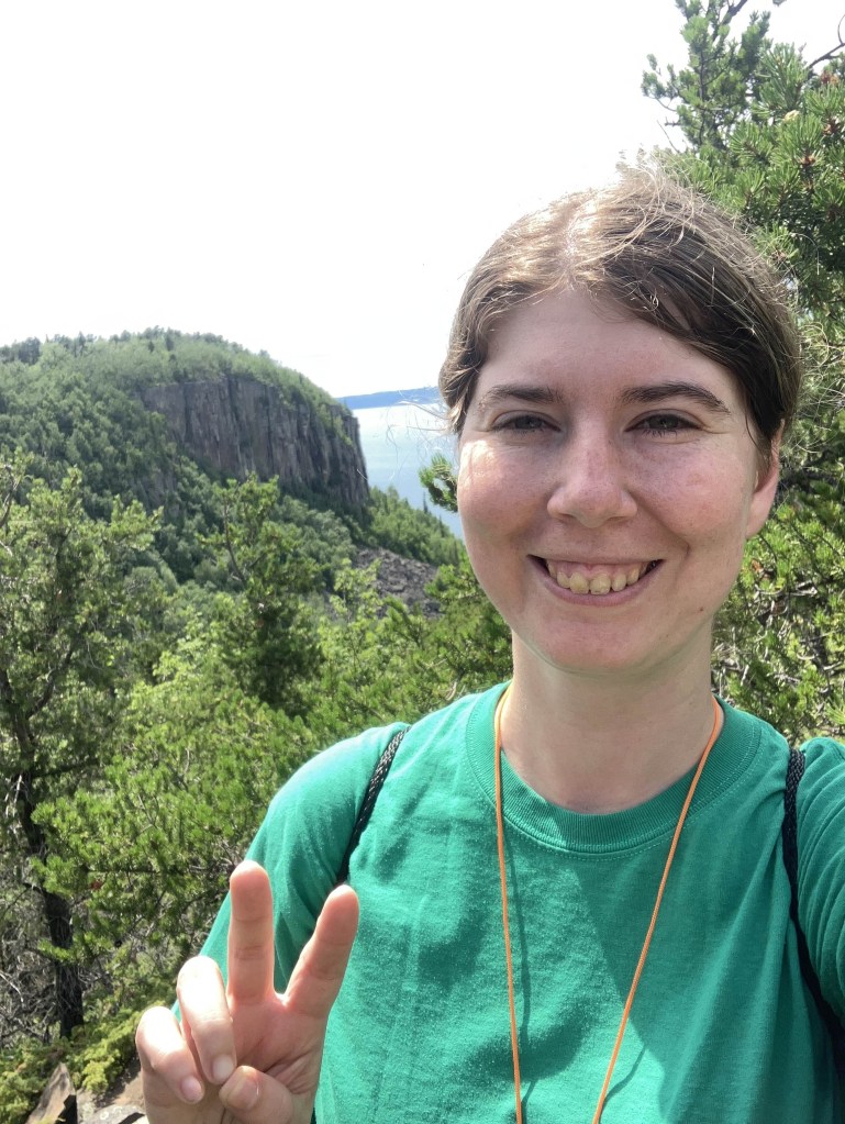
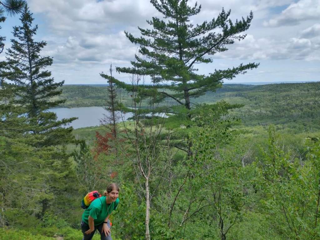
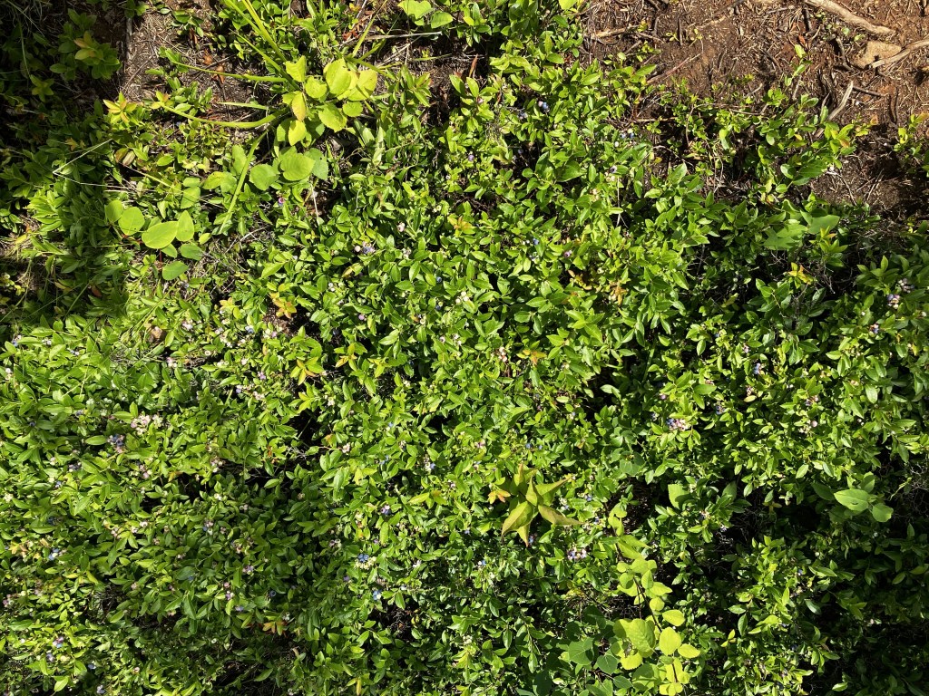
I threw my arms up silently, still too out of breath to yell triumphantly like I wanted to. The jagged shale gave way to large, rounded chunks of granite. We had left behind the tall poplars and found groves of short, sparse evergreens, and a steady ground cover of what looked like juniper bushes. There were wild blueberries growing in abundance, although mostly not ripe – that would explain the black bears. They were teeny tiny, although I did grab half a handful. Surely a little bit of wild blueberries wouldn’t throw me out of Keto.
We walked over to the part of the cliff that overlooked Thunder Bay. The folly of man, how small the city of a hundred thousand people looks in the distance!

We sat down on the cliff and tried to have lunch. I had packed an acceptable keto meal of meat and cheese, but I was too tired to make myself eat it. Also, I was running pretty low on water, and eating anything would make me thirsty. So I just had a little to eat.
We also got visited by a little squirrel, who was probably used to begging for food.
People say the descent is just as hard as climbing, but I would beg to differ! It took us half the time to descend and I didn’t feel out of breath once. We passed a family with a small dog – and got compliments on my whistle – and the mother had a baby in a harness on her back. And people say women aren’t as strong as men!
We stopped at Sawyer Bay again. I took my sock and shoes off and stuck my feet in the water to cool down for a few minutes. Someone was setting up camp for the night and I debated asking him for water, but I was unsure if it was a faux pas.
In any case, I drank all of Hanuman’s water instead! So we were both thirsty for the walk back.
We walked directly back to the parking lot. Very little picture taking or conversation now. We got back to the parking lot around 6, so it took us approximately 6 hours to do the hike. We did find some wolf scat in the middle of the trail, which made me laugh at the idea of a wolf crouched in the middle of the path!
I did the loop around Silver Islet because Hanuman had never seen it, and also because they have a store that sells water. I was heartbroken when I got up to the cash with my bottle of water, and the cashier was distracted by a woman that came in with a small dog. So close and yet so far!!
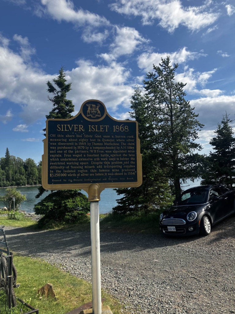

Silver Islet is a gorgeous little town to take a drive through. There’s just a collection of small cottages on one side, the road so perilous close to the crumbling lake edge on the other that you worry you might go over at some points! The road is also only a lane and a half wide, so you want to take it slow and keep your eyes peeled for pedestrians and people coming from the wrong way.
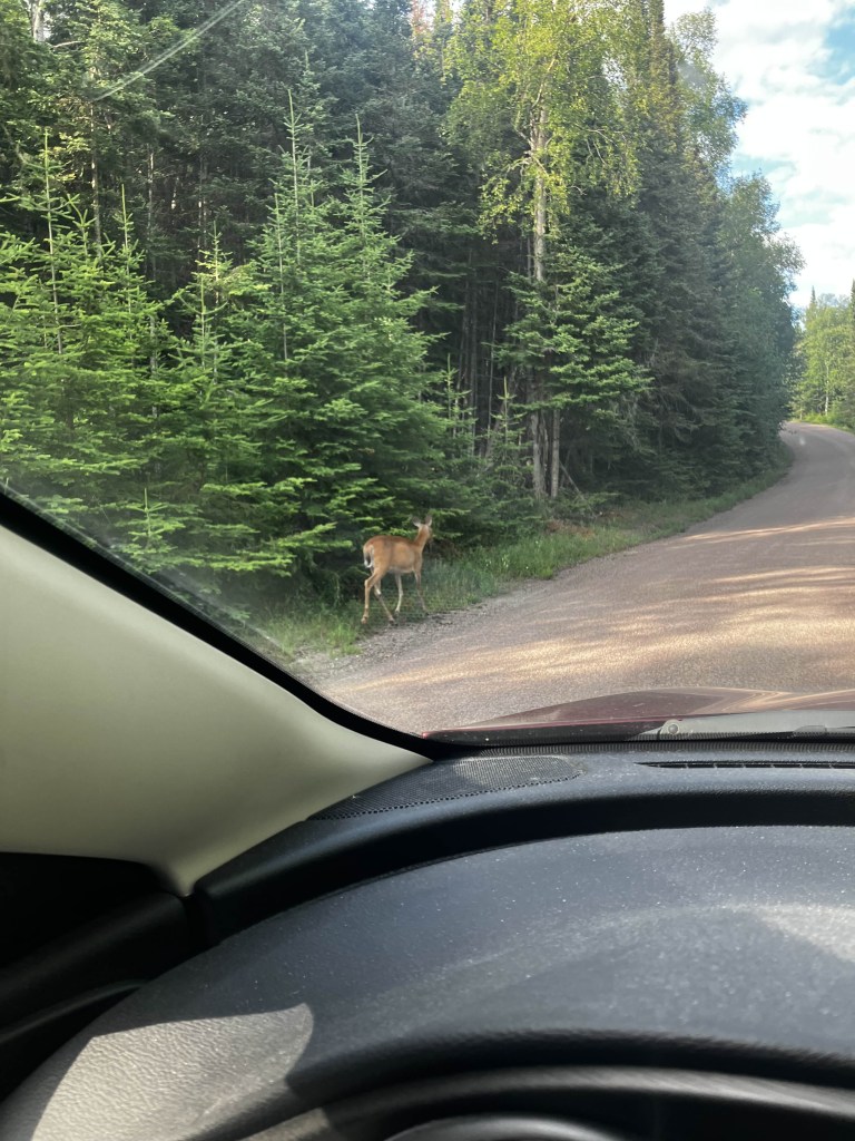
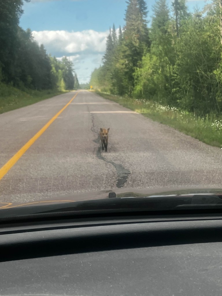
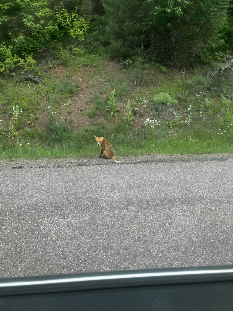
As it was late in the day, wildlife started to make an entrance. Some deer feasting by the side of the road. But also, a fox who attempted to hunt my car, before attempting to eat an apple core left by the side of the road. Hanuman observed he still has chunks of his winter coat on and he must be starving, for some reason. Unfortunately, nature must take its course.
And thus concluded our adventure!

I fell into German again for naming. There is a very old Nazi Zombies map called “Der Riese”, which means “the giant” in German. It has nothing to do with a literal giant – the name refers to an fictional arcane Nazi plan called “the Giant” (a plan that involved meteorites and zombies). At the time, it was the best map and had the best theme song. The songs were fun too, they were Easter eggs that had to be activated through a series of esoteric actions not otherwise hinted at. No I don’t play the new Nazi Zombie maps, they’re too gimmicky! I miss the days of repairing windows with boards, when the Carbine was one of the good guns and the Wunderwaffe was fun for a hot minute but really not that useful.

Leave a comment