By Lucy
Well, the time had come and there was no denying it anymore.
The first thing I did Thursday was call Paul and have a panic attack. What if I forgot something, what if I got lost, what if the bike broke down, what if my load became unsecured. My biggest concern, actually, is the fact that I don’t have a hard top… again. I wanted to park at Mt Aoraki and do the 5 km hike there, but it is almost peak tourist season and someone might grab my bag off my bike.
That really is my biggest concern. I don’t have much for way of valuables, and they could easily fit into my helmet bag and be carried on my person, but most potential thieves won’t know that. They would grab my bag, leaving me with no spare clothes or toiletries, and then probably toss it in a dumpster!
The hostel said I could leave my bag there (they usually do), which adds an extra hour to my drive time in backtracking, oh well.
Finally the clock ticked on to 9 and I decided I should probably go deal with the chickens. We had some milk turn to yogurt in the fridge, so that went into their food bowls as well. As Paul says, chickens are the ultimate trash disposal.
As I waited for the water dishes to fill, I noticed a chicken laying down, its legs sticking out behind it instead of neatly tucked under it. I took a step forward, and another chicken started pecking at its head.
“No!” I raced forward and grabbed the chicken off the ground, cuddling it in my arms like a cat. It was still very much alive, but its legs were tied together by a string like a bola. How did it do that? I went and turned the water off, and jogged up to the house with the chicken in my arms.
It was very strange to be holding a chicken as if it was something soft and cuddly. I expected it to protest, but it seemed quite content to nestle into my arms; perhaps it could sense I was trying to help it. Simo chuckled and cut the offending piece of string off, and I took it back to its pen.
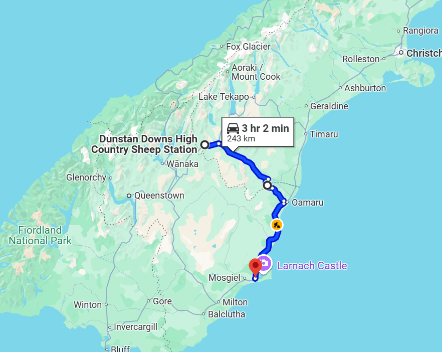
I spent the day cleaning and packing. Well, not too much cleaning and packing, to be honest. I only have the one bag, after all. But Simo agreed to let me leave some stuff here, so I was choosing what I might need for the next month to 2 months. Nothing says I couldn’t stop back here after I’m done in Queenstown if I decide I want to swap something. And then, since I plan on selling my bike in Auckland and taking the train back down, I’ll put everything for the bike in a box and ship it back to Canada to save hauling it around with me.
I wiped everything down thoroughly, as there would be new woofers the same day. Then I took the passenger seat cushion off the bike, which gives me more anchor points for the bungie cords. Unfortunately, I do have to bring the seat with me anyway, so I can reattach it for selling the bike in Auckland.
I decided to sit and memorize the manual for the bike, which is when I realized I had made a mistake again and Mike had tried to correct me without actually explaining himself (-D for effort, Mike, you were a journalist, you should write better than that!). What I thought was the choke is actually the fuel valve. The choke is hidden on the handlebars, but crucially, it was off the entire time. Which means 1 I’m still an idiot, 2 why does the bike have a choke if it can apparently start without it, and 3, why did it break down to begin with?
Paul convinced me the bike probably still needed the carb cleaned anyway, but I was still feeling foolish. The bike still wasn’t starting properly either, even though I was now following the start procedure to a T.
Simo had the door to her office closed most of the day, so I stewed in my cabin alone.
The next day, I left shortly after 10, later than I meant to, but still well within my plan for the day. I fed the chickens one last time, let Luigi out one last time, stripped the sheets from my bed and shoved them in the washing machine. I stopped and surveyed the land I had spent the last three months calling home. Would I be back? Would I really miss it?
I went in to say goodbye to Simo and drop off my box.
“What’s in it?”
“You can go through it if you want, just clothes and a couple of things.” I shrugged.
She offered me a hug and I accepted.
“Text me when you get there, I worry.” She said. Then the phone rang and she disappeared back into the house.
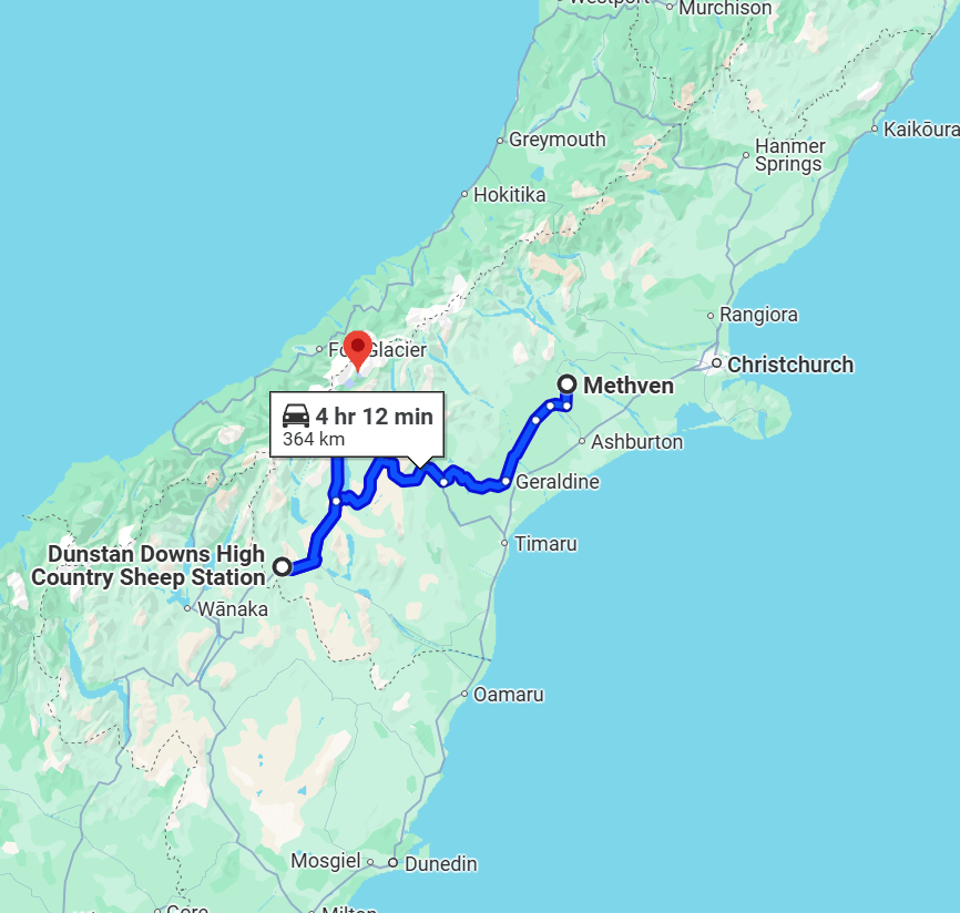
The road is called “Inland Scenic Route 72”, but no scenery was to be had by me. A proper British fog had descended, cold and wet and miserable, and completely obscuring my view of the beautiful Southern Alps. Oh bother. Good thing I had spent extra money on the waterproof bag!
At 11:30, I reached Geraldine. Geraldine is a nice little town, a little bougie. A lot of jams and juices made in New Zealand say “made in Geraldine” for a reason.
I stopped at the first place I came to, called Geraldine Farmshop and Cafe. After I shook off the cold and damp, I ordered a flat white and a croissant sandwich. I was sort of hungry but not really, and I wanted to stop for a proper meal closer to my destination.
It took me longer than expected to warm up. The cafe is nice, but drafty, and they were clearly prepared for the warm sunny weather the forecast proclaimed and not whatever this was. I noticed my bag had shifted slightly to the right, probably from how I was leaning on it. Easily adjusted. It was staying put rather well, actually.
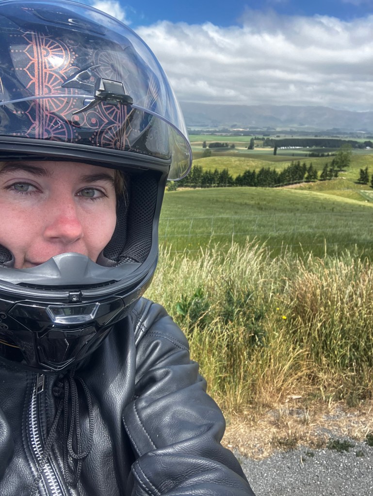
I started out again. The sun finally started to break through the clouds and a warm breeze started up. I turned off 72 onto highway 79. As Simo said, this road started to descend into a valley. I stopped at Fairlie to gas up, having used only half a tank of gas to go 170 kilometers. 10 bucks per 200 clicks, not bad. I figured gas would be cheaper here than Geraldine as well. With a gut feeling, I bought a tube of Pringles. I was off the beaten path and food options would be short; a back-up snack that I knew my belly would tolerate was a good idea.
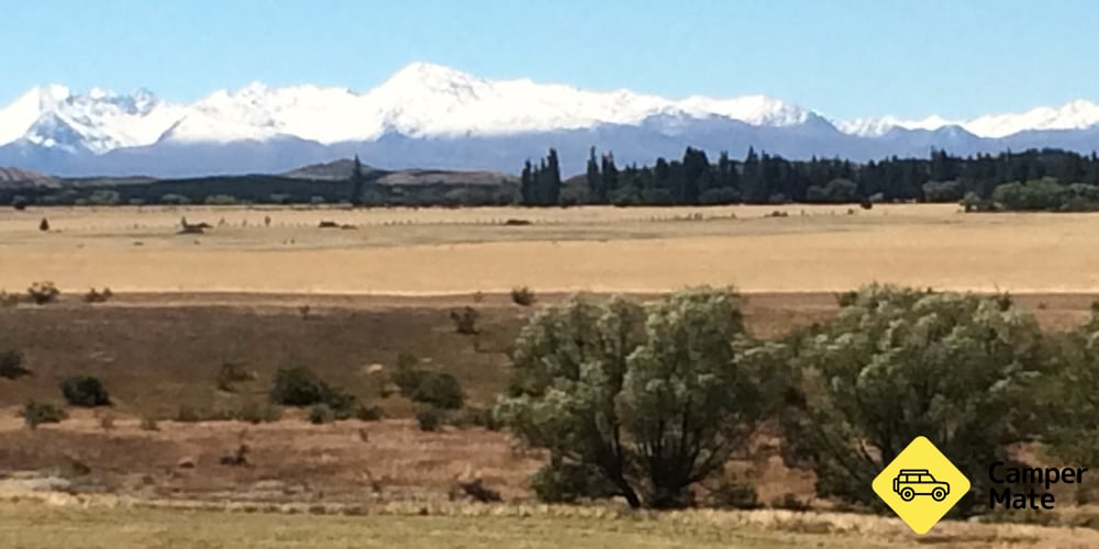
The wind here changed, alternating between a pleasant warm breeze and a bitterly cold one. Still descending, and then I turned a corner and the whole plain was laid out before me. Shrubland, and on the other side a row of picture perfect snow-capped mountains! I pulled over at a lookout to do the touristy thing, take pictures and stuff. I moved on quickly, both because I was nervous about my time budget, but also because all the happy families were getting on my nerves. I was starting to feel tragically alone.

If you have looked at a map of my route, you’ll notice that I’m zigzagging a lot. Most of this was the path of least resistance, weaving through the mountains. I had left behind the orderly British lines and flatness of the Canterbury plains and was entering rough mountain territory. If you could draw a straight line from Methven to Aoraki, it would probably only be an hour drive, and it still wasn’t even that long considering I had gone from the middle of the island, to the coast, and back to the middle again. However! It looked like the big loop around to Tekapo is to avoid another mountain, and it is a lie. There are just sheep fields. You could honestly make a road straight from Burke’s Pass to Lake Pukaki and shave 20 minutes off your drive.
Since it was tourist season, I was passing the usual insane people bicycling from coast to coast. Still, I feel more of kinship to these people than the ones in the cars, insulated in their little bubbles. These people were out here, braving the elements and living in the moment. I often honked and waved as I passed these people, and they usually waved back, sometimes even before I honked.
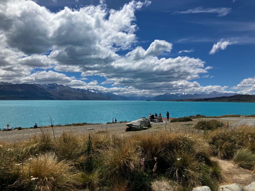
I didn’t stop in Tekapo. I figured everything here was overpriced, the lake looked the same as Pukaki, what’s the point? It was gorgeous though, the clear turquoise colour just like Rakaia, except the sun caught each wave with a gleam like a facet of a diamond, sparkling like a great green gem set in the middle of a picturesque valley. In that moment I understood why this is a tourist destination.
The wind got ferocious from here, battling me. I was hunched over the handlebars again. I passed a sign that said “International Dark Sky Reserve”. Interesting, but I wasn’t coming back out here on the bike, especially considering how late the sun set now.
Lake Pukaki was the same as Lake Tekapo, a glittering green gem by the side of the highway, except no town and no people to spoil the view. I pulled over at the viewing point, which has a large parking lot with a bathroom, and took some pictures. I realized it was getting on for time, so I had some of my water and Pringles, and took my meds. One of the tourists had a drone flying around, getting in people’s faces, and since I was sitting on my phone people asking if it was me. No? Do you see space on that motorcycle for a giant camera drone?
The next leg is where I made a mistake. I should have either booked a hostel in Twizel proper, or just tried to find a place to stash my bag in Aoraki village. Since I had decided to go right to the place I was staying, I drove past the turn off for Aoraki. Psh, an extra 40 minutes here and 40 minutes back… peanuts.
I regretted it immediately. The wind was relentless and draining. Between mountains was a surprisingly wide plain, although I was unsure where the wind was coming from and why.
A few things caught my eye. There were regularly large mounds, covered in white plastic and a layer of tires. Like, many, many tires. Why?
I passed a place called High Country Salmon that offered to let you feed and then catch your own salmon for dinner, which sounded fun. Maybe next time!
I drove through Omarama and was really starting to second guess myself. Too late now.
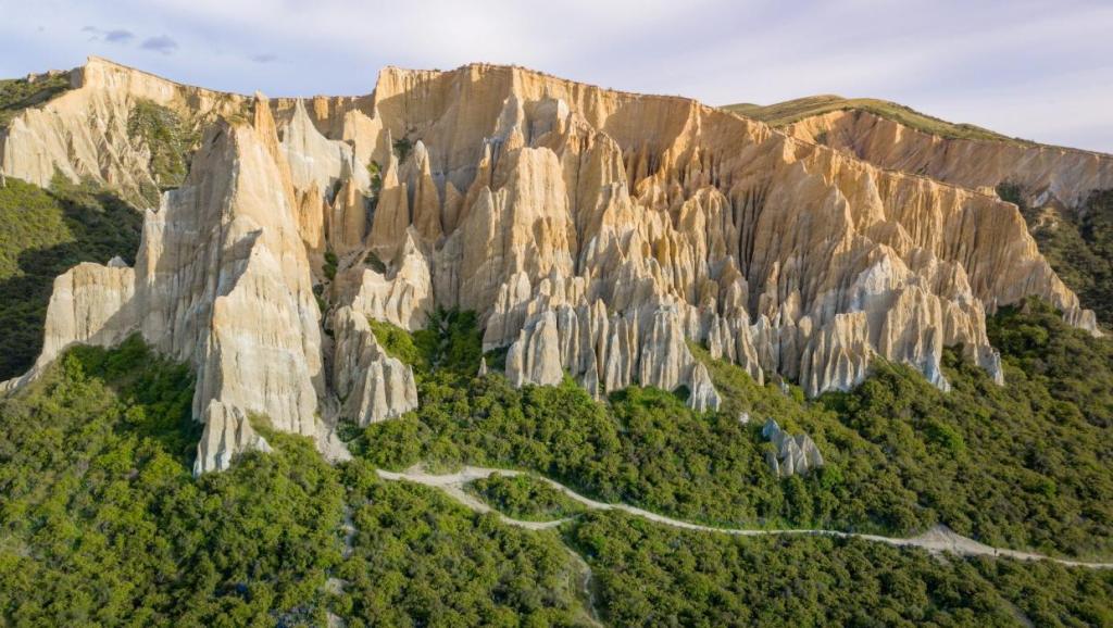
Along the way I passed the clay cliffs. You can spend 5 bucks to go down a gravel road and walk thru them, but they are easily viewable from highway 8 and there’s even a spot to pull over to see them, so.
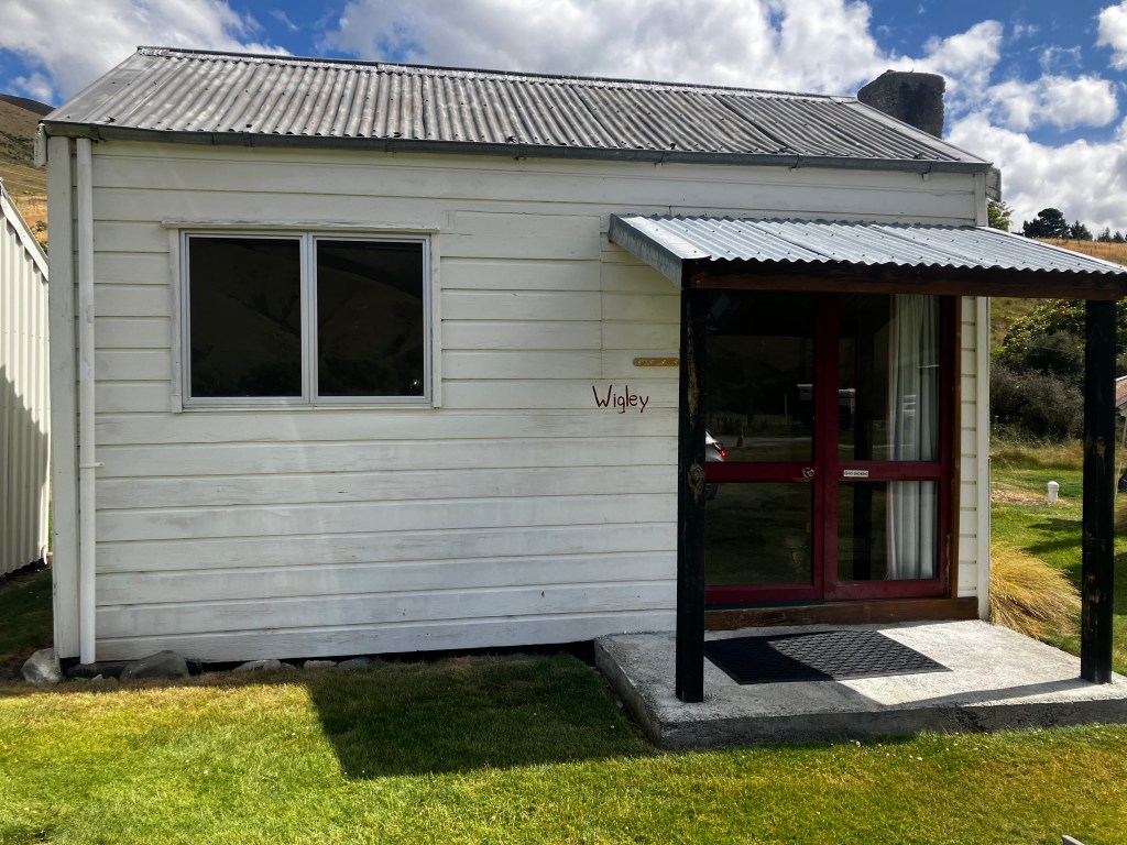
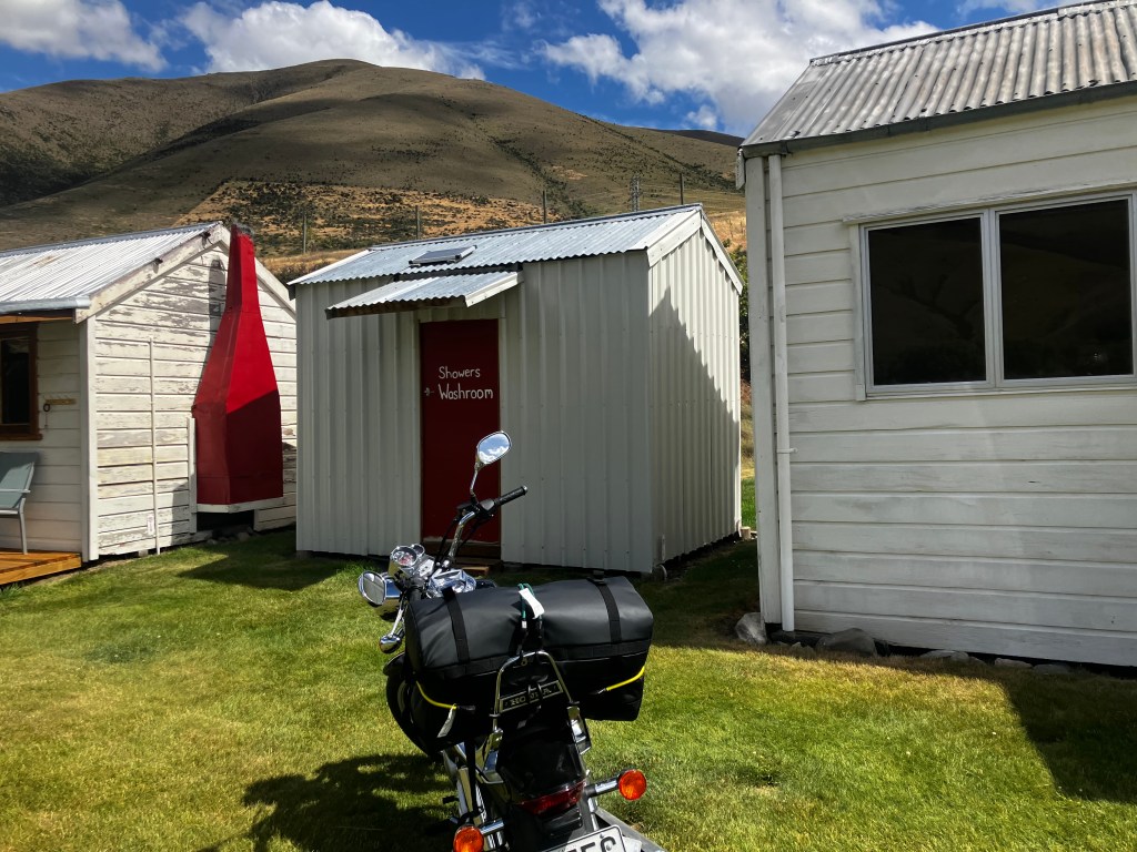
Ten minutes past Omarama was where I was staying, Dunstan High Station, named for the nearby Dunstan Mountains. My heart sank further as I realized it was a collection of cabins on a gravel road. I followed the signs for the office up and up the twisty gravel road and parked next to a bull-type dog, who sat up for pets.
I walked around the building uncertainly, before walking up the steps to a balcony where the door was cracked open. A voice inside called, “Come in!” As I stepped inside, there was a little old lady seated at a desk. “You must be Lucy.” She nodded to the helmet I was still wearing. “I didn’t hear your bike.”
“It’s a quiet bike.”
She handed me a ring with 3 keys on it, “This is for the kitchen, this is for the bathroom, this is for the cabin. You’re in Wigley, just you so far. Check out is tomorrow, strip the sheets off the bed but not the duvet cover, and leave the key on the side table. No need to come back up here.”
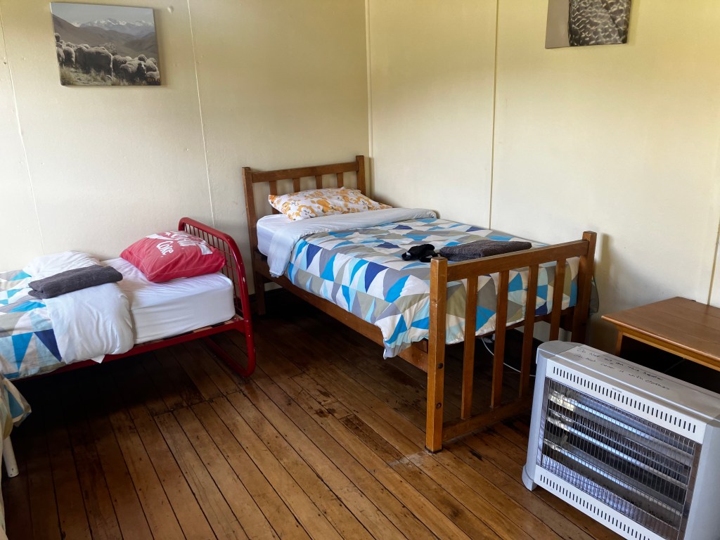
I went back down the path. The cabin wasn’t much to look at; 4 beds, a boarded up fireplace, a heater, an easy chair. I would say 40 bucks was too much for this, honestly, but at least I wouldn’t be sharing it. Since I had my pick of the beds, I wanted the one at the back, but the one closest to the door ended up being the only one with an outlet. I unpacked my bags and headed out again.
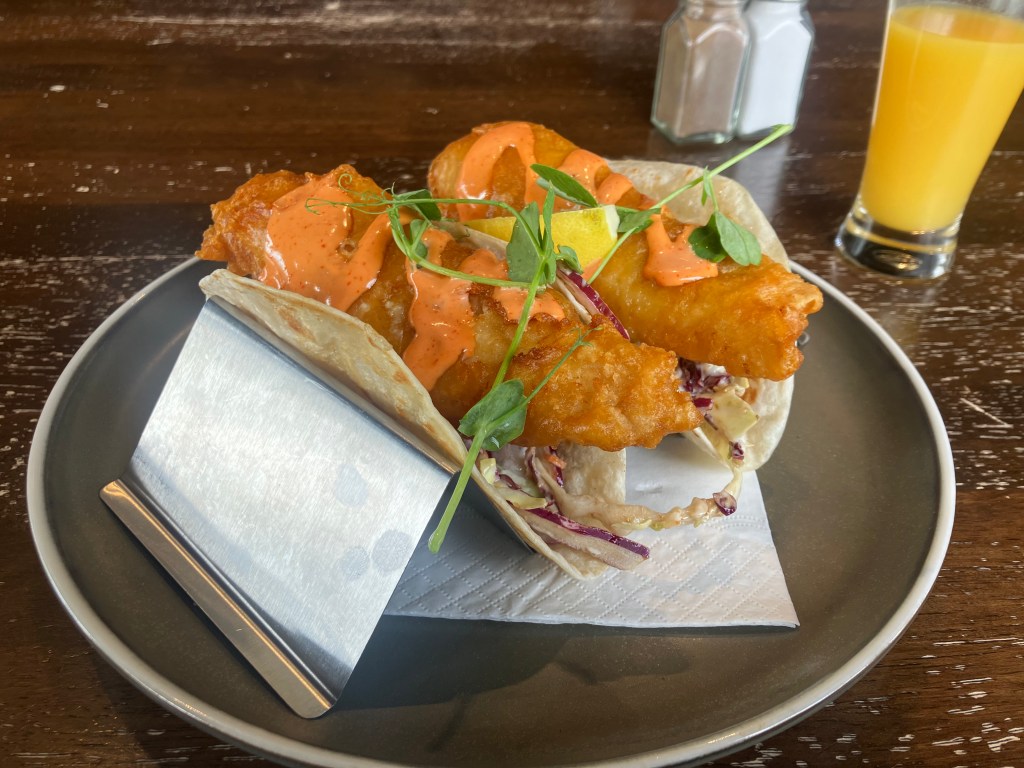
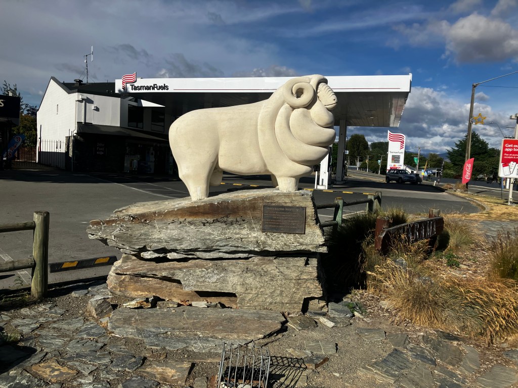
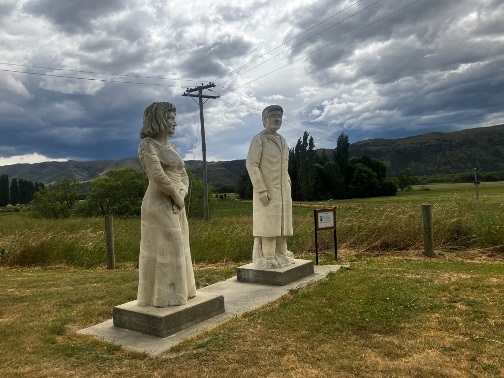
I headed back into Omarama for lunch. I stopped at a hotel bar, the only place that seemed to be open (so many places close at 4) and had fish tacos. I texted Simo to tell her I was ok and had arrived safety and she asked me if I had climbed on the sheep statue yet.
Back up the road.
This is truly the Lord of the Rings gauntlet. Twizel is where the battle of Pelennor fields were filmed. The land is privately owned as well; the owner used to do fabulous tours, but stopped after the pandemic for whatever reason. Again, you can view it from the road.
Minas Tirith was filmed at Aoraki, and Lake Town was filmed on Lake Pukaki.
It only took half an hour to get back to where I’d turned off, and the sun wasn’t supposed to set for another 3 hours, but I already wasn’t feeling great about my choices. The weather changes on a dime at Aoraki, and it had turned. It smelled like the sea, and great clouds hung low throughout the mountains. As I sped up the flank of the great green lake, occasionally the clouds would release a burst of rain.
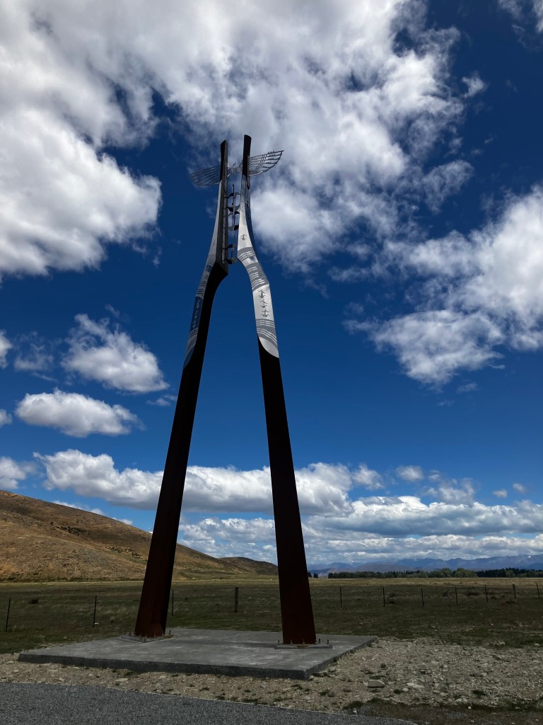
Then I turned one bend and the mountain was before me. Aoraki, my heart whispered. It means “cloud piercer”.
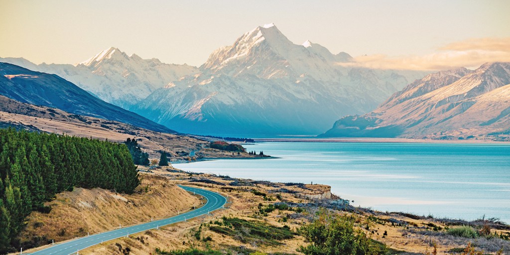
I realized that I’d always had some mental image of mountains as being too tall to see the top of. It makes sense; it takes multiple days to climb them, so anything that takes further than a day to walk must be out of sight, like the horizon. Except Aoraki is only 3’700 metres high, not even 4 kilometers. If it were horizontal, you could walk it in a couple of hours.
I didn’t stop for long. I had every intention of doing a little walk, maybe the Hooker Valley track (what a name). But the sun was quickly disappearing behind the rain clouds, and I didn’t want to end the day fleeing from another rain storm. Maybe I could come back when I was done at Glenorchy. I took my pictures and headed home.


Boy, was I cold, wet, tired and annoyed when I got back to my cabin. 10 bucks of gas and 2 hours of my time, wasted.
I was thrilled to be able to change into clean, dry clothes, pull the heater over to the easy chair, and kick back. 540 kilometers, 7 hours was my total travel time for the first day. Fitbit didn’t know what to do with my heartrate and decided I’d walked 30’000 steps and burned over 3’000 calories, which was probably accurate, The wear on my arms as I wrestled with the wind was probably the most exhausting part.
Woops. I’d be sore and tired tomorrow!
Sleep was restless. The bed was comfy and the sheets warm, but the seal around the door was janky and the door rattled in the frame when the wind howled thru the valley. There’s not a lot of traffic along this road, but it seems in the night it hosts a lot of tractor trailers, who’s noise was also not kept out by the door. It rained off and on throughout the night and I had a fleeting panic that the water-saturated grass might let my bike fall over.


Saturday started bright and early; there was a small window, high on the wall with no curtain, letting in sunlight. Also, a bird with a high, melodic call was trying and apparently succeeding to get into the metal sheeting for the shack.
The earliest any food place was open in Omarama was 7:30, so I rolled over and buried my head in the sheets until 7. I heard the car for the other guest fire up around them, but she probably cooked breakfast.
Well, might as well get up. I felt exhausted still. Brush my hair, pack up my stuff, make another chilly walk to the bathroom, strip the sheets off the bed per the sign. Key on the table, strap my stuff to the bike and I’m off. The rain clouds have parted and left behind rainbows.
Last night’s “it’ll be fine” is today’s panic. My bike is tired too, and the needle is dangerously close to empty. I can’t get it to idle steadily and take off anyway; all this futzing around is wasting precious gas. I get to the gas station in Omarama with no excitement, fill up, and pull 50 meters forward into a parking spot for the cafe.
They have eggs Benedict! But I resist and order bacon and eggs with toast, a 10 dollar savings. It comes with a lot of bacon and two eggs, are eggs more expensive than bacon here? Curious.
I’m out of there before 9. For the next hour, the road is mostly quiet as I follow the Waitaki river south-west. I’m sort of off the beaten path, although it’s still early for tourists. The first bit is all windswept hills and mountains dotted with tufts of tussock, brown grass in the gaps, not even any sheep to break up the monotony. Then you reach a bit where you go up and up and up, and over the crest is a lovely view of Lake Aviemore.
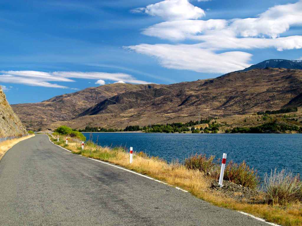
Now I was travelling the route Chris had sent me, the Alps 2 Ocean.
Around Kurow, the breeze got sharper, and carried with it the smell of the sea. I wasn’t that close; is the river brackish, or is it just a quirk of the wind?
Shortly before Duntroon, there was a small parkette that promised Maori rock drawings, but after I started up the path I discovered it was blocked off due to rock fall. Would have been nice if that sign was visibly from the road!


Duntroon itself is small, but it tries very hard. My first port of call was the Vanished World Centre, one of the few destinations that had been on my mind since I stepped off the plane. I was hoping I could park my bags in some back room and go on a bit of a walk, as well. The centre seemed oddly small.
I was ten minutes early, so I waited. And waited. 10 minutes turned into 20. Both the sign and Google said they should be open, what was going on? Someone asleep in the back room?
A woman came around the front. “We’re not technically open, but I felt bad since you were waiting.” When I opened my mouth, she answered my unspoken question; “The volunteer called in, so no one is “here” today.”
“Oh.”
“But you can come in!”
I can? Why? I grabbed my bags and followed her in. “It’s ten dollars to look around, and we have the video in the back if you want me to start it up.”
“I wouldn’t want to be a bother.” I said sheepishly. If she was fine with me skulking around the exhibits while she did other work, that’s alright with me.
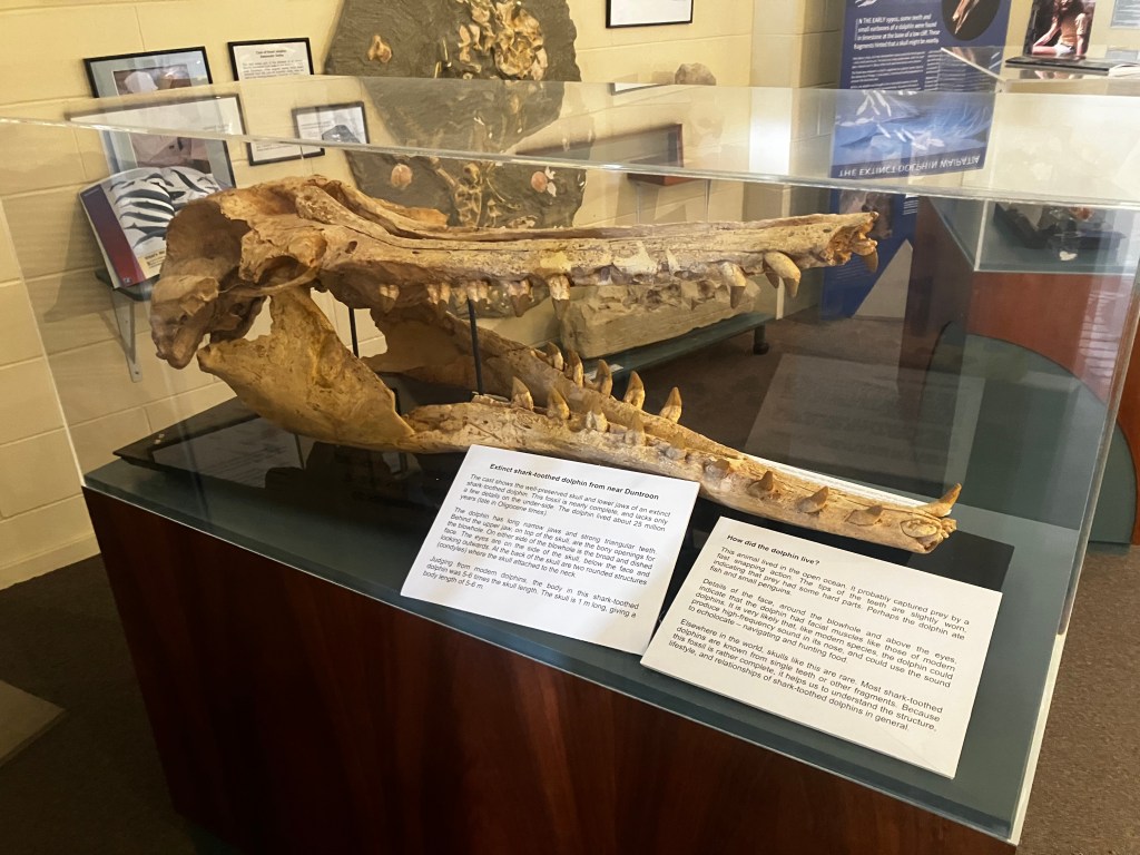
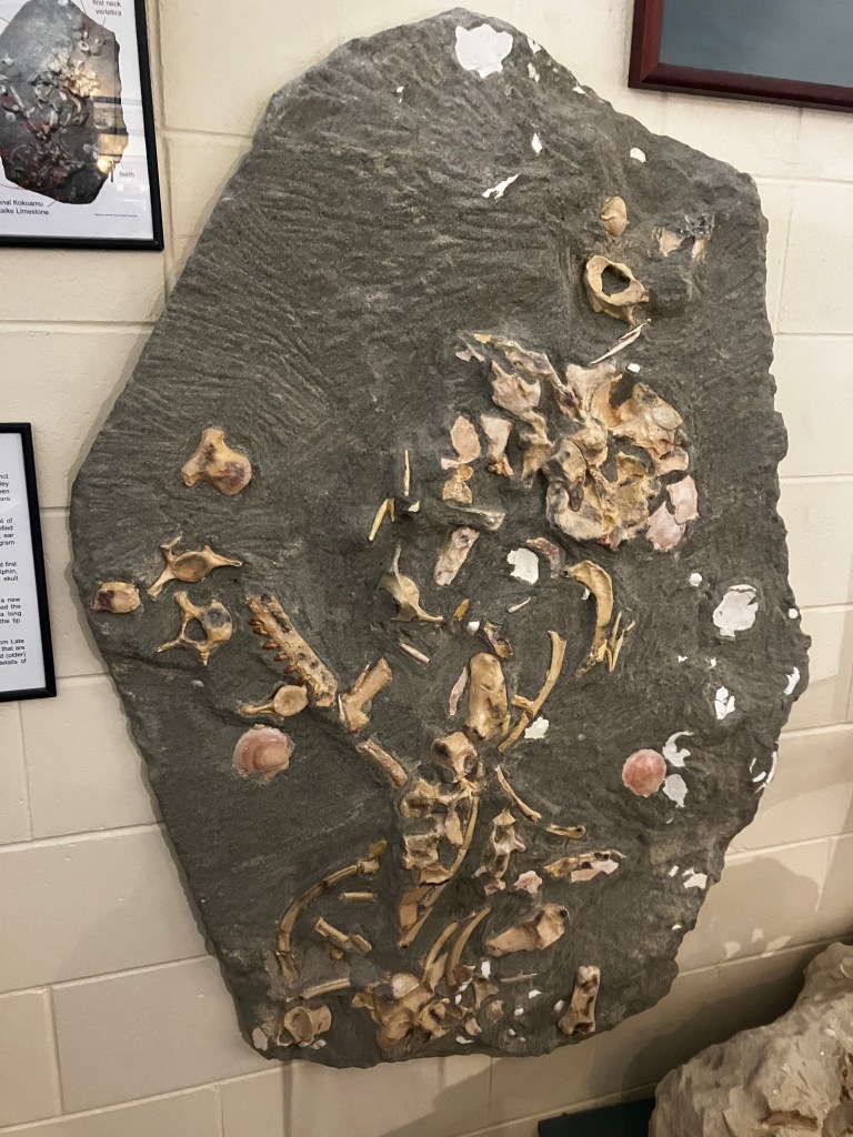
We chatted as she darted around, doing this and that. She’s the only paid staff member, although she has no degree in paleontology or geology. She knew everything about the museum’s contents, the surrounding area, and Zealandia, and was happy that I knew a fair bit already. She explained that a lot of this was the work of one man; Dr Ewan Fordyce, who unfortunately passed away last year. He had bonded with all the local farmers to convince them to allow digs to happen on their land, argued for funding from governments and institutions, and blazed the trail for the work here. Now he was gone, there was no one left to fight for them.
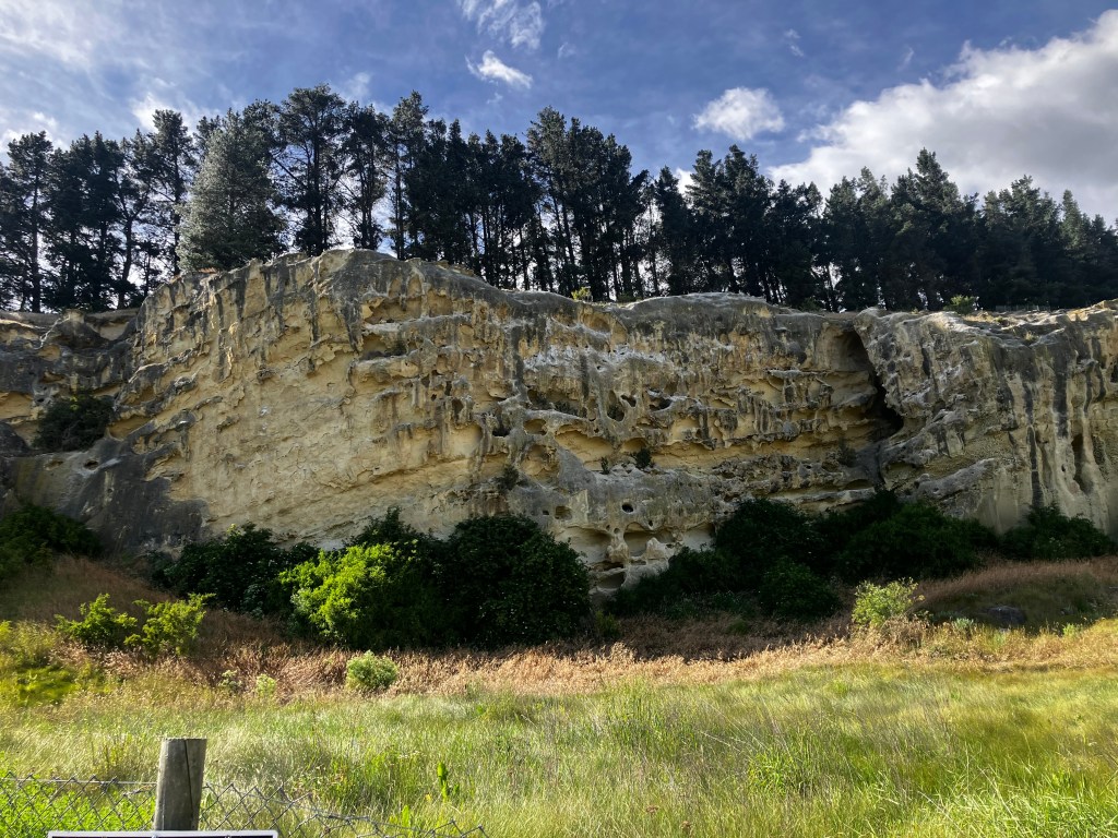
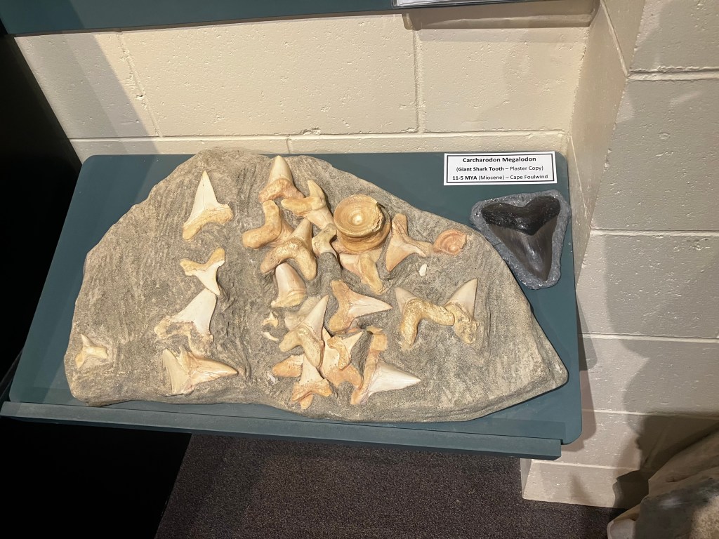
The limestone around Duntroon is the same limestone as is around Castle Rock; 30 million years old, formed when the sea got cold and all the sharks died. But there were many novel and important fossils here, including a missing link between dolphins and their distant ancestors, which had feet and could go on land. The area is also host to a unique kind of rock called greensand, which was formed as the sea level dropped. It is full of microfossils of foraminifera, ostracods and coccoliths, which are just as important as the large sexy dinosaurs. The green colour is from glauconite, an iron potassium combination formed in seawater.
On the less profound level, this area is also known for “rattling rocks”, peculiar geodes created when hematite formed a ball around something not hematite, like a rock or some sand. The unopened geodes rattle like maracas!

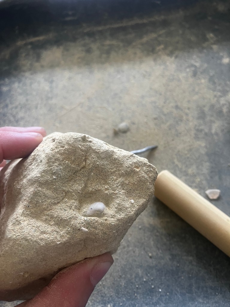
She let me do a little “dig” in a chunk of limestone. I found small sections of a shell.
I wished I could have stayed to chat with her longer, but people started to notice that someone was in the building. I decided it would be prudent to leave so they wouldn’t be hassling her to let them in.
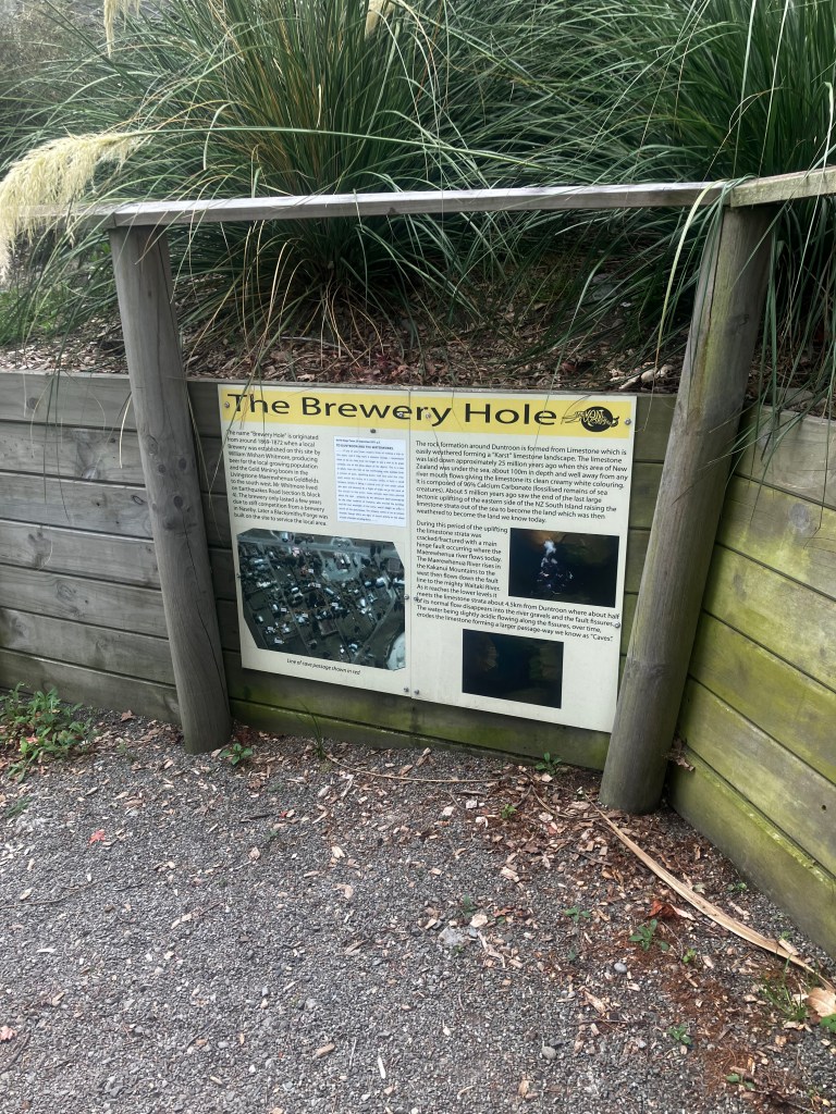
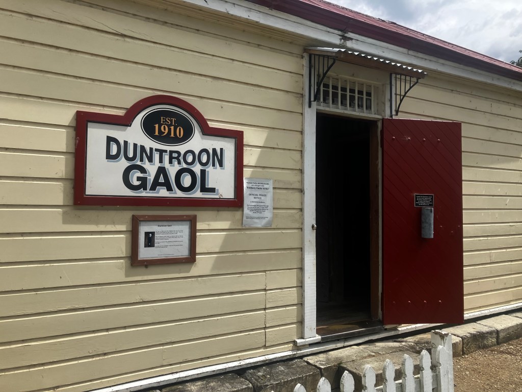
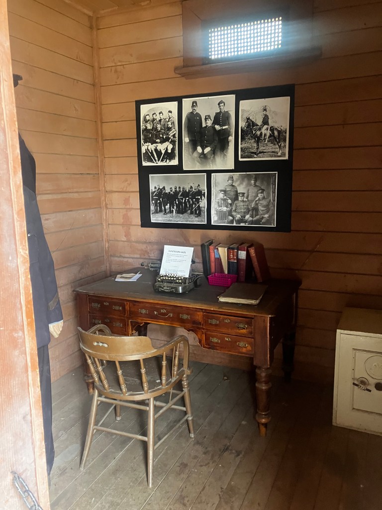
As I wandered down the road, I passed an active blacksmiths’ and a mock gaol. I also stopped at the Brewery Hole, a underground river which had worn thru to the surface here.
I stopped at the Flying Pig for lunch. It was a cozy little cafe, all painted pink with lots of pig decorations. I asked why it was called the Flying Pig and they said to be quirky. I ordered another croissant sandwich (lots of those lately) and a tropical smoothie that was to die for!


I wanted to do a walk around town, but I didn’t want to leave my bags behind on the bike or bring them with me. Back on the bike and away we go, I guess.
I couldn’t do much of the dinosaur route because it was gravel road (again). So I missed the “Earthquakes”, so named because it was thought they were formed by earthquakes, but they were actually formed by the soft limestone slumping into the same underground river that made the Brewery hole.
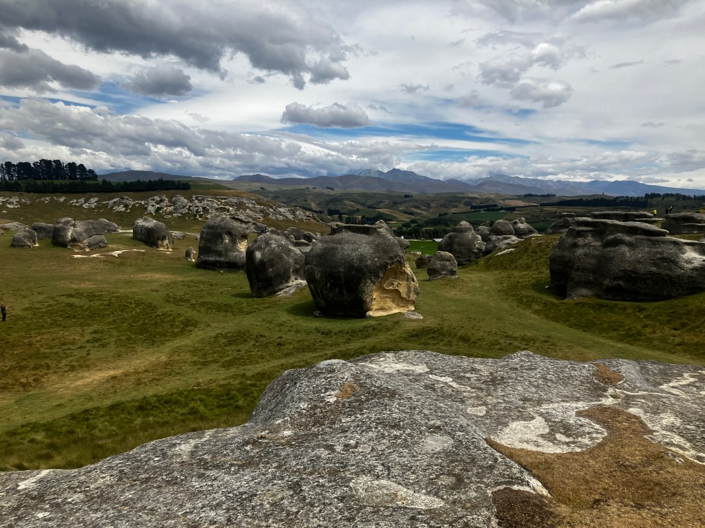
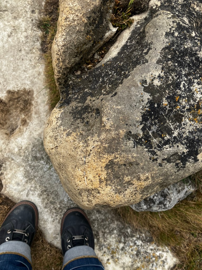
I stopped at the Elephant rocks. They were formed in the same manner as Castle Rock. They are noteworthy because the Chronicles of Narnia was filmed here, as Aslan’s camp. I didn’t stop long; I was cold and tired, and it was basically the same as Castle Rock.
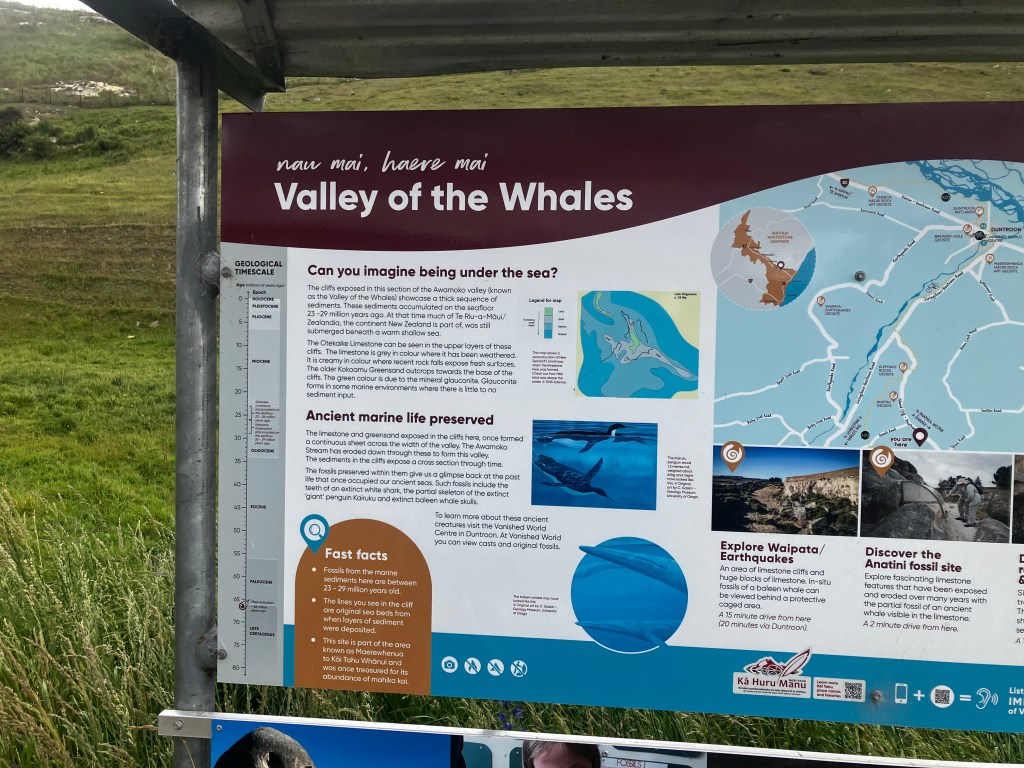

The road from the Valley of the Whales was so scenic! The limestone was hewn close to the road, at some points forming a roof over the road. You could see the strata very clearly from the road! I can’t say it’s better than the road straight from Duntroon to Oamaru, having not travelled both, but I preferred the twisties with the limestone cliffs. I probably saved time not having to cut through Oamaru as well.
My only complaint is that when you reach the town of Weston, there is 0 signage as to which of the 5 possible roads you should take. I had to pull over and consult Google.
Now I was technically finally in Otago, despite having considered myself to be in Otago once I passed Tekapo. I view Canterbury as the “tamed” portion of the southern island, which was behind me. I joined highway 1 going south to Duntroon.
Ye gods do I hate New Zealand highways. At least there was finally something resembling a hard shoulder, but it was still only a one lane wide country road. Why is this so difficult?
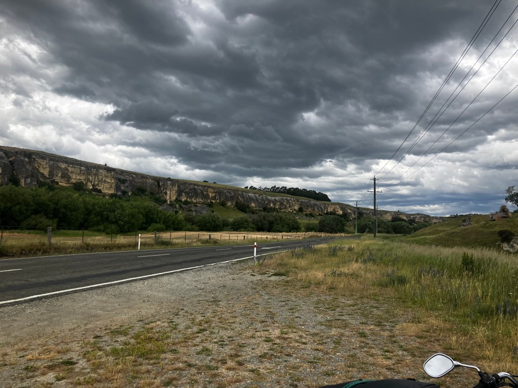
The windswept brown hills gave way to lush green forested ones, the road curving as it skirted river valleys. The better to view the rain!
All at once it was upon me, rain so hard I’m pretty sure there was hail in the mix, cutting and soaking me to the bone. I had to slow down, which did nothing to endear me to the people behind me.
Finally I pulled over at a gas station. I didn’t desperately need gas, but I would before Dunedin and it would give me a moment to gather my bearings.
There was only a 30 percent chance of rain; indeed, as I stood there beneath the canopy, it started lightening. But in an hour it was a 70% chance, continuing well into the evening. Time was of the essence now.
A little bit into the ride, I found the sea. There’s a section before Palmerston where the road hugs the coast. Fierce winds tossed giants waves onto the shoes, probably contributing to the moisture on the road. The Pacific. Somewhere over there was Canada.
After Palmerston the road got hilly. At a few points it was so long and steep I had to drop down a gear. Insanity! Passing zones started appearing and I made sure to slow down even more so that everyone got ahead of me. I also found a few “slow vehicle bays”, obviously meant for tractor trailers, but what’s the difference between them and a passing lane? I don’t know, but I used them as well. The road was intermittently wet as I passed through bands of rain but I didn’t feel like trying to make up time on the dry bits. It was too hard to tell where the next batch of rain might be.
(I also passed a town called Shag Point, hah hah. That’s for Graham!)
A few times I debated stopping at a cafe to grab something warm and defrost myself. I talked myself out of it each time; the weather was only going to get worse and stopping is expensive.
Finally, I turned a corner and saw a large collection of houses. This must be Dunedin, there was nothing else this large in between…
My heart sunk as the road descended into a valley ringed with terraces.
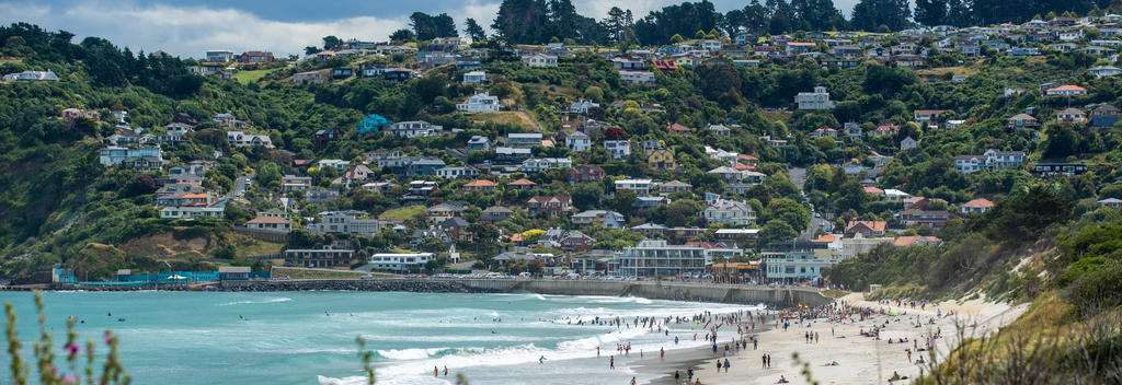
It was hilly. For some silly reason, I had glanced at the map of Dunedin, noticed it was by the sea, and decided it ought to be flat.
As I passed into a downtown core with dedicated one-way traffic and granite steles, I exclaimed “It’s Edinburgh!”
And so it was, Edinburgh 2.0: Tropical flavour.
No no no no no no, I was tired from yesterday’s ride and today’s ride and the rain, I did not have the strength necessary to wrestle the bike to a halt on a steep hill! Why why why? How come no one had looked at the bike and said “hey, Dunedin is hilly, you’ll be alright on the bike?”
Well, there was nothing for it now!
I got lost. Or, more accurately, as I frequently do, I panicked that I had missed my turn and turned too early. Pulling over to check for directions is even more hazardous on a steep grade, although I am pleased to report I did not stall, drop the bike, or hold up traffic because I was unable to start at any point. Whatever I was running on was more potent than adrenaline.
Finally I made it to my hostel, soaking wet, shivering, and exhausted. Thank all the gods there was a parking spot right out front. I peeled myself from the bike, hauled my luggage inside and booted the door in.
“Did you just get off the bus?” The clerk asked, as she checked me in.
“I rode a motorcycle here.”
“Oh no! In the rain? Poor thing. Well, you can go right upstairs and curl up next to the heater! Take a towel.” She gestured to a shelf behind me.
I didn’t bother with the heater. The room was draped in other people’s belongings, and my major gripe with hostels continued to be the lack of places to put things. I ended up with a top bunk, so I couldn’t even stash stuff under the bed. I found a clear spot on the floor to dump everything, changed into dry clothes, and crawled into bed.
Sleep eluded me. My brain was running a mile a minute. I pulled out my phone and started looking around.
I noted that there was a noodle place next to Chemist Warehouse, one of the places I planned to shop. Well, why not? I pulled on my wet leather jacket and my shoulder bag and took off.
I felt elated, once I was on the streets. Edinburgh had been my favourite part of the trip to England and this was giving me a massive dose of nostalgia. The cobbled streets, dedicated pedestrian thoroughfares, the freakin’ hills. Sidewalks covered with canopies, storefronts offering all manner of wares, tartans everywhere. The downtown core wrapped around a bay. The only thing missing was the actual Scots.
I wished Rich was here. He’d love it.
My first stop was the liquor store. I’m tired and sore and my head is spinning. I wanted a mickey to tide me over until I reached Queenstown, but this store just had large bottles. They also had a sale on Baileys that was very tempting. I did a few laps of the store before landing on a bottle of the wine Regan had in Akaroa.
The clerk smiled. “Finally decided?”
Yeah, I probably seemed sketchy, wild-eyed from the road.
“ID, please.”
I handed him my passport. His eyes grew wide.
“Do I look like a Kiwi?” I asked, smiling.
“Yes.”
“I also confuse people by being almost 30, too.”
“Yeah, you look 20 or 21.” He handed my passport back. “Lucy.”
Something about me had grabbed his attention, in the sea of tourists. Interesting. He followed me outside and chatted with me as I tried to stash the bottle in my bag in such a way that it didn’t look like I had wine with me.
Off down the road. Dunedin, or D’need’n as it is pronounced by the locals, is organized around a city centre which is shaped like an octagon and called the Octagon. On the other side was a large indoor mall called the Meridian which rivalled the Eaton centre. In here I found the Chemist Warehouse, which looks like Honest Ed’s, right down to the yellow, blue and red signs.
I wish I had known about this place sooner. I grabbed some Metamucil; I wasn’t close to being out, but there wasn’t a Chemist Warehouse between here and Glenorchy, or along the west coast, so this was my last chance for cheap Metamucil. It was even cheaper than Amazon because they had a store-opening sale. I also grabbed a small bottle of sunscreen, mostly for my tattooes. On a whim I grabbed a nice three-blade razor, so I could use the hot tub at Glenorchy without feeling self-conscious. The last thing was a bottle of creatine.
Creatine is the newest panacea that will cure what ails you, rah rah rah. However, some studies have found that creatine can help women in particular build more muscle and my concern, as always, is cachexia. If you are a regular muscular man or a lazy bum who doesn’t want to work out, creatine will not do a thing for you and I laugh at the people who do 30 minutes on the treadmill and then take some protein supplements like they think they accomplished something. I figured, no harm in getting a bottle and trying it at Glenorchy. If it doesn’t work, it’s just 30 bucks.
Lastly, I grabbed some ramen from the Japanese place across the road and walked back to the hostel.
This was one of the hostel with the signs saying “ALCOHOL MUST BE CONSUMED DOWNSTAIRS” so I settled in the dining room with my noodles and a glass of wine. My roommates were two German girls, although I am unsure if they came together or just happened to bunk in the same room. They were content to talk German amongst themselves.
Some more people finally filtered in with dinner. A man sat next to me with some toast. “Hello, where are you from?” He asked me.
“Canada. Thunder Bay.”
“Never heard of it. I’m from England. Kent.”
“My friend is from Kent, I spent a month there earlier this year!”
“What part?”
“Chatham.”
That reminded me, I popped open Discord and scrolled down to Rich’s chat. He would enjoy the pictures of Dunedin.
Error. You can’t send messages to this account.
Wow, really?
Another guy sat down across from me. “You’re Canadian too?” He was from Toronto, lame. Still, it was nice to meet someone who knew where Thunder Bay is! We got into a long discussion about how fake the maple syrup is here, naturally. The two other guys who eventually joined us were from Finland and Sweden.
Around 10, I excused myself for bed. Today’s drive was less strenuous, only 240 kilometers and mostly sunny and warm. Still almost 3’000 calories, and I had not eaten enough to make up that deficit. I was going to lose weight on this trip.

Leave a comment